
Subscriber’s Copy. Not for Sale YOURGEOSPATIALINDUSTRYMAGAZINE R.N.I NoUPENG/2010/34153; Registration no: UP/GBD-136/2017-19 Publication: 10 th of Bi-monthly I Posting: 15 th / 20 th of every second month www.geospatialworld.netMAY-JUNE2023»VOLUME13»ISSUE03|ISSN2277—3134 BEYOND THE SHELVES Location-Intelligence, spatial analytics, and emerging technologies such as AI, IoT, and AR/VR, are enhancing consumer experience


Editor-in-Chief
Sanjay Kumar
Dazzling World of Retail
Retailers have realized that the way forward is no longer about physical vs digital, it’s omnichannel. With technology adoption becoming more widespread, Location Intelligence is instrumental for exceeding customer satisfaction and imbuing value-addition.

14 / Smart Retail for Next-Gen Consumers


Morten Brøgger MapsPeople
DATA INSIGHT
Managing Editor Prof. Arup Dasgupta
Contributing Editors
Geospatial Infrastructure

John Kedar
Global Defense and Security
Keith J. Masback

Associate Editors
Geospatial World
Aditya Chaturvedi
EMEA
Meenal Dhande
Asia Pacific
Sarah Hisham
Assistant Editor
Nibedita Mohanta
Sub Editors
Sachin Awana
Richa Tyagi
Jeffy Jacob
Chief Designer
Subhash Kumar
Visualizers
Pradeep Chauhan
Saurabh Srivastava
Circulation
Harender Rawat
Vijay Singh
Disclaimer
Geospatial World does not necessarily subscribe to the views expressed in the publication. All views expressed in this issue are those of the contributors. Geospatial World is not responsible for any loss to anyone due to the information provided.
Owner, Publisher & Printer: Sanjay Kumar
Printed at All Time Offset Printers F-406 Sector 63, Noida - 201 301, Noida (UP) India
Publication Address
A - 145, Sector - 63, Noida, India
Geospatial World: The edition contains 48 pages including cover. Geospatial Media and Communications Pvt. Ltd. A - 145, Sector - 63, Noida, India Tel + 91-120-4612500, Fax +91-120-4612555/666
Price: INR 150/US$15
CONTENTS INTERVIEWS TECH TRENDS IN-FOCUS CASE STUDY 04 / Editorial REGULAR FEATURE FEATURED 26 / Towards Immersive Mixed Environments 34 / Open Map Data Sparks Creativity, Innovation 06 / Future is Here: Reimagining Retail Experience 30 / Drones Redefining Retail 36 / AirAsia Unlocks 7 Million Free Seats Promotion Through DOOH Campaign 38 / Optimizing Navigation in Southeast Asia with Localized Mapping 37 / Streamlining Shopping Experiences with Indoor Navigation 29 / Domino’s Data-Driven Expansion in Indonesia 12 / Fighting Utility Outages with High Resolution Satellite Imagery 44 / St. Louis becomes “GEOINT Central” as Esri announces its move to The Globe Building 43 / Zeroing on Sites with Right Insights 39 / Tangled Knots: Data Privacy Implications in Retail
13 / ISSUE: 03
VOLUME:
Clifford McDowell CEO, Doorda
Marc Prioleau Executive Director, Overture Maps Foundation
COVER STORY / 16
Sky is the Limit
It is often said in a light-hearted manner that geospatial applications is a solution in search of problems! Indeed, the spread of geospatial applications from natural resources management to city management, to healthcare and more is perhaps an indicator of its versatility. David Schell of Open Geospatial Consortium, remarked that geospatial applications are only limited by our imagination.
Business Intelligence has been integrated with geospatial systems for applications such as warehouse and store locations, understanding customer preferences through demographic mapping and routing delivery vehicles, to name a few. In retail the use of location and routing has been used for delivery from brick and mortar and online stores, food aggregators, taxi aggregators and other such B2C applications.
Real estate dealers have used both geospatial and BIM to present property details online such as location, 3D view from location, 3D property details at various levels, etc. The insurance industry also uses location and other details to calculate property valuation and insurance. The government also uses such data to determine property tax.
Beyond these, new areas are opening up as e-commerce and online retail gets more popular. In-store location is one such application which can lead customers to their desired products as well as to advertise new ones.One of the most interesting ideas is to use cosmic particles that can penetrate buildings as a medium of communications for location where GNSS signals fail.
The new kid on the block is Metaverse which allows a customer to directly interact with a store and ‘try out’ designs on a virtual persona, an avatar, of the customer before buying. Physical location of the store is not a limitation but a delivery or physical pick up from a nearby location requires location and routing assistance through geospatial systems.
Metaverse will also improve on property deals as it enables the avatar of the prospective buyer to actually be on the location and walk around while talking to the dealer’s avatar. Again, on a lighter note – will avatars also be able to touch, feel, taste and smell? Quite an ask but who knows.
While these applications are realities or will soon become realities, there is always a fly in the ointment. As technology progresses, it enables many facilities, but it also facilitates crime. The protection of the legitimate customers, and safeguarding the privacy of their data becomes a paramount concern.
This aspect needs to be addressed in sync with the new applications. Does geospatial systems have a role to play in this area of personal security?

4 | www.geospatialworld.net | May-June 2023 EDITORIAL
Prof. Arup Dasgupta arup@geospatialworld.net


6-8 September 2023 Virginia USA 22-23 August 2023 New Delhi India 16-19 October 2023 Hyderabad India 9-11 January 2024 Monterey California 6 December 2023 Mumbai 13-16 May 2024 Rotterdam Europe Produced By www.geospatialworld.net Save the Date Year after year, the Geospatial World Conferences maintain their reputation as the ‘must attend thought leadership’ events. GW
2023-24
EVENTS-CALENDAR
Future is Here
Reimagining Retail Experience
Tech integration, fast connectivity, and immersive hyper-real applications are transforming the way people shop.
 By Sachin Awana
All the visible universe is nothing but a shop of images and signs.
The breath-taking technologies and astounding innovations that are dominating the discourse today would have been exclusively reserved for the glitzy home of Iron Man, had it been 2008. Such is the exponential pace of innovation.
In the realm of retail, newer technologies and innovations are shaping people’s shopping experience, making it more interactive and immersive. Meanwhile, Indoor Mapping, Geofencing, Artificial
Intelligence, and Extended Reality are taking the centre-stage in reorienting retail for the future.
Experience-as-a-Service (EaaS) models have been popping up with luxury brands taking the lead by crafting curated experiences for their customers. Generative AI and Extended Reality seem to be on the cusp of becoming the next versions of smartphones, integral to everyone’s daily lives.
Between all this frenzy, there
~ Charles Baudelaire
~
are various facets of shopping experiences, and most of them are ridden with technology that work behind the scenes.
Growth Ahead
Talking numbers, in 2021, the global retail market generated sales of over $26 trillion with a forecast to reach over $30 trillion by 2024. For this year, it is projected to reach $28.64 trillion. Region wise, Asia pacific is projected to amount 61% of the world’s e-commerce business, according to Statista.
6 | www.geospatialworld.net | May-June 2023
TECH TRENDS
$30
The technologies supporting these growth are expansive in nature; intertwined with other technologies, and show endless innovation capabilities.
Moreover, the landscape for retail technology has widened than ever before. Newer technologies are now being implemented in various branches of the retail sector be it ecommerce or physical stores.
Here are the technologies that are shaping the way consumers shop:
Extended Reality
Virtual screens, hand gestures, and an immersive experience combined, presents an opportunity that seems straight from a science fiction movie or throwback to some graphic dystopian novel. But with major breakthrough in technology, Augmented Reality and Virtual Reality applications are being embedded across domains.
For brands/companies, this will result into a much more efficient inventory management, less returns, more personalised shopping, and better data analytics and collection.
Moreover, this will also minimize the need for physical store expansions.
Until now, majority of the online shopping experience have been in 2D. XR will present consumers a new 3D platform that will enhance the overall shopping experience. The XR devices will enable customers to virtually try on products such as clothing, accessories, or cosmetics.
It will also allow retailers to showcase their products in an interactive and engaging manner. Through AR or VR experiences, customers can explore and interact with 3D models of products, rotating them, zooming in for closer inspection, and even customizing certain aspects.
Extended Reality has the potential to transform the retail industry by providing immersive and interactive experiences that enhance customer engagement, improve product visualization, and streamline the shopping process.
Artificial Intelligence
It’s no surprise now as to what and how AI can affect the lives of humans. The modules of AI are endless, and so is its applications.
For retail, AI has been contributing in number of ways. From analysing consumer behaviour through extensive data to streamlining workflows and manging inventory, it has been providing unparalleled value all around.
AI is being extensively used in majority of retail practices. Be it logistical demands or analysing stacks of data, it helps in every nook and corner. The foreshadowing of
AI in retail had been witnessed all the way back in 2018 when Amazon had announced 1-hour delivery on its platform by region-wise forecasting of various products and moving them into small warehouses for efficient and quick delivery.
The applications of AI span Inventory Management, Interactive Chat, Customer Insights and Engagement, Demand Forecasting, and Operational Optimization. This translates into capitalizing the purchase power that a customer comes by.
Various major and unconventional players like Hitachi, Accenture, and Intel have jumped the gun to set-up their own AI enabled data platforms that provide these solutions to a number of retail stakeholders around the world.
$31.18 billion in 2028
The global market size of AI in retail is expected to reach $31.18 billion in 2028 at a CAGR of 30.5% from $4.84 billion in 2021, according to Fortune Business Insights
The latest breakthrough in AI –Generative AI – has become a point of contention as well, mired in speculative fear and fraught with issues of ethics and compliance. Big retailers are gauging their way
May-June 2023 | www.geospatialworld.net | 7
The global retail market generated sales of over $26 trillion in 2021 with a forecast to reach over $30 trillion in 2024
FACT AND FIGURES
trillion in 2024
FACT AND FIGURES
to incorporate this latest trend for making their entire workflow automated and efficient. The moral implications, mounting job losses, and other disruptions are all under consideration, as employers and employees seek ways to minimize its adverse impact on humanity.
Metaverse
Metaverse is a mega virtual world with seemingly no end. The opportunity that it presents for retail and commerce is second to none. Retail in Metaverse could be understood as an extension of e-commerce, where instead of 2D viewpoint, customers can interact in 3D with materials, clothes, and other items.
FACT AND FIGURES
$936.6 billion in 2030
In 2023, Metaverse is expected to rise to $82 billion, before surging to $936.6 billion by 2030
According to a GE Capital Retail Bank research, 81% of consumers conduct online research before
making a purchase. The Metaverse has the capability of eradicating this research and provide a more immersive experience. Almost a game-like configuration where consumers can step in the virtual stores and get the feeling of being in a highly personalized shopping space.
In 2021, luxury apparel brand Louis Vuitton stepped in the metaverse by realising a mascot that users can play with. Another luxury brand Balenciaga entered the virtual world by launching skins and apparels for characters in Fortnite. Other big retail brands such as Adidas, Walmart, and Nike also followed suit and kept their one-foot in the Metaverse.

One could either review products in a more effective manner by making their avatars – a digital version of the customer – wear it to gauge how it would look on themselves or buy it as a digital product that their avatar would wear.
Internet of Things (IoT)
A widely-used technology, Internet of Things (IoT) devices are present in everyday scenarios. In simple terms, everyday objects such as refrigerators, cars, air conditioners, lighting, fitness trackers, and similar items are connected to the internet for smart connectivity and data collection. This is achieved through small hardware pieces such as actuators, sensors, and programs that are embedded in IoT-enabled or smart devices.
IoT also presents a tremendous capability of interoperability. Current trends already show IoT devices using the likes of AI, Analytics, AR/VR, 5G etc. Going ahead, this amalgamation might
expand across various industries beyond its current applications.
$82.31 billion in 2026
The global IoT in retail market was valued at around $19.4 billion in 2020 and is expected to reach $82.31 billion in 2026
“There’s no doubt that Industrial IoT is the future. With democratization of electronics and rapid advancements in 4G/5G rollouts, we are at the cusp of Industrial IoT revolution,” said Naman Jain, CEO, Falcon Autotech.
Rom Eizenberg, Chief Revenue Officer, Konkakt.io identifies pervasiveness and multi-use approach as two defining IoT trends.
"IoT has increasingly been adopted by major network providers like Cisco into their access points and has become a part of their network upgrade/refresh cycle. More recently, IoT is also being integrated into smart lighting, which means significant cost-savings and ease of use for large and small retailers alike", says Rom.
"IoT is also crossing the border of storefront customer experiences and expanding into the supply chain, logistics, and in-store distribution", he adds.
“Trend 2: Multi-use approach. IoT technology is also crossing the border of storefront customer
8 | www.geospatialworld.net | May-June 2023 TECH TRENDS
FACT AND FIGURES
Luxury brand Louis Vuitton’s game in the Metaverse
experiences and expanding into the supply chain, logistics, and in-store distribution,” she added.
The global IoT in retail market was valued at around USD 19.4 billion in 2020 and is expected to reach USD 82.31 billion by 2026, growing at a compound annual growth rate (CAGR) of around 27.6% during the forecast period.
Location-as-a-Service (LaaS) Utilizing geographical location from a user to deliver content, information, or functionality relevant to their whereabouts is at the core of Location-as-a-Service model. The services usually rely on technologies such as GPS, Wi-Fi, cellular networks, or Bluetooth to determine the precise location of a user or device.
FACT AND FIGURES
$402.4
consumer behaviour and targeting them for curated advertisement.
New York-based Social Network Service providing firm Foursquare allows users to discover and share information about local businesses and attractions. Users can check in at specific locations, leave reviews and tips, and receive personalized recommendations based on their location history and preferences.
“Location Intelligence enriches property information by providing valuable geospatial context. It integrates sociodemographic data, real estate market trends, environmental risk assessments, surrounding infrastructure, and points of interest information. This enables professionals to target specific buyer segments, forecast property values, assess environmental risks, and evaluate the desirability of a location," said Yanqing Zeng, Lead Data Scientist at JLL.
the location industry. The expansion of technologies such as AR/ VR, Metaverse, and eCommerce is set to increase the role of Location services even more as the need for better curated content and even more personalized ads.
Indoor Mapping
For retailers with huge stores and vast number of products, Indoor mapping comes off as a magic wand. Mapping out the entire store area, aisles, and products makes the entire shopping experience smooth and efficient for the customers.

Indoor Mapping involves capturing, modeling, and visualizing the layout, features, and points of interest within a building to provide accurate and interactive maps for navigation and location-based services.
Location technology can be used for navigation, mapping, advertising, proximity marketing, emergency services, and asset tracking among other applications. The market for location data is huge, and so is its use. Geofencing is another example where location technology plays a pivotal role in understanding
“Location Intelligence empowers data-driven decision-making and enhances market analysis in the real estate industry,” she added.
The location technology market trend shows the growth spur of
Most of the times, Indoor Mapping relies on technologies such as LiDAR (Light Detection and Ranging), 3D imaging, Wi-Fi fingerprinting, Bluetooth beacons, and other sensor-based systems. These technologies scan the area around them and chalk out the details of the physical structures, layout, dimensions, and objects within a building.
May-June 2023 | www.geospatialworld.net | 9
The market for global location technology based services was valued at $45.4 billion in 2021, and is projected to reach $402.4 billion in 2031
billion in 2030
Live in-store navigation with the help of Indoor Mapping
$92.36 billion in 2030
From 2022 to 2030 at a healthy CAGR of approximately 32.56% to attain a valuation of around $92.36 billion by the end of 2030
This also helps in mapping the points of interests like restrooms, information desks, shops, restaurants, and other amenities in a huge area. By providing accurate and interactive maps, indoor mapping enables users to find the shortest routes, locate desired destinations, and navigate efficiently within buildings.
The maps can be integrated into mobile applications, kiosks, or digital signage systems, allowing users to access the plan and navigation assistance on their smartphones or interactive displays. This not only help customers and visitors with better
efficiency but also increases the customer experience.
Macy’s, a New York based retail giant in has implemented Indoor Mapping in majority of their stores across the USA. Company developed an app for the customers from where they can use the application. The app provides a detailed indoor map of the store, including different departments, sections, and brand-specific areas.
The map highlights points of interest, such as customer service desks, fitting rooms, restrooms, and elevators, making it easier for customers to locate these amenities within the store.
Macy has also integrated their mapped area with the store’s inventory. Customers to check product availability and get real-time information about stock levels. This helps them make informed decisions about their purchases.
“The global Indoor Mapping market is predicted to thrive substantially during the assessment timeframe from 2022 to 2030 at a healthy CAGR of approximately 32.56% to attain a valuation of around USD 92.36 Billion by the
end of 2030,” according to Market Research Future.
Autonomous Delivery
Autonomous technology is being hailed as one for the future. Surprisingly, that future is not far off. Already hundreds of retailers and service providers have started using autonomous drones and vehicles to move their product around and deliver it to the customer’s home.
Autonomous delivery vehicles are equipped with advanced sensors, cameras, and navigation systems that allow them to perceive their surroundings and navigate without human assistance/ on their own. These vehicles can operate on roads, sidewalks, or dedicated delivery lanes, depending on the regulations and infrastructure in place.

It is especially relevant in lastmile delivery, which refers to the final leg of the delivery process from a distribution hub to the customer's doorstep. Last-mile delivery is often considered a challenging and costly aspect of the logistics chain, and autonomous delivery can help address these challenges by offering efficient and cost-effective solutions.
These autonomous bots have better reliability and efficiency and also eradicate the possibility of human error. As the technology rises and sees more innovation, we could feasibly see drones and pods roaming all around us delivering groceries to houses in a matter of minutes.
Starship technologies, a Robotics Company, is using their
10 | www.geospatialworld.net | May-June 2023 TECH TRENDS
FACT AND FIGURES
Starship Autonomous Robot’s delivering goods
robots to navigate sidewalks and deliver packages within a certain radius. Several retail companies, including grocery stores and food delivery services, have partnered with Starship Technologies to test autonomous robot deliveries in various cities.
"The benefits of autonomous delivery for the logistics industry are clear from both an efficiency and environmental perspective. Robotic delivery is affordable, convenient, and environmentally friendly, enabling services to be deployed at a fraction of the cost and with no-hassle for the customer", said Alastair Westgarth, CEO, Starship Technologies, in an interview with Geospatial World last year.
While talking about last-mile autonomous delivery, Daniel Laury, co-founder and CEO, Udelv in an interview said, “End-to-end
last mile battery-electric autonomous delivery solutions answer the two greatest challenges of modern commercial fleets: a massive shortage of drivers and the electrification of fleets. But they also require the end consumer to meet the delivery vehicle at a time and location of their choosing to retrieve their goods.”
Live Warehouse
Until the recent years, warehouse management has been a tedious work that many types of technologies or humans have tries to make efficient. However, not much had come to fruit until recent years when moving storage aisles were developed.
Automated warehouse management involves the integration of realtime data, connectivity, automation, and intelligent systems to enhance efficiency, accuracy, and productivity in warehouse management.

Smart robots or Automated Guided Vehicles (AGVs) moving around some set perimeter, the aisles fitted with IoT sensors, AI, and ML, have become a thing of trend. From Amazon to Walmart, moving aisles have been reforming workflows of major retailers. So rather having to go on a search and find trek in a stadium-area-warehouse, the aisle containing the item which has been ordered comes to you. These specially help in timely and efficient deliveries.
Automated Guided Vehicles are equipped with sensors and navigation systems to move efficiently and safely without human intervention. AGVs can transport pallets, bins, or other containers, optimizing the movement of goods within the warehouse.
Last year, Amazon Robotics debuted two fully autonomous warehouse robot, Proteus and Cardinal. The company said in its blogpost, the robot “can operate in a manner that augments simple, safe interaction between technology and people — opening up a broader range of possible uses to help our employees — such as the lifting and movement of GoCarts, the non-automated, wheeled transports used to move packages through our facilities.”
The world of retail is huge, and with the addition of internet into it, the end seems to be endless.
As Tim Berners Lee said, The Web as I envisaged it, we have not seen it yet. The future is still so much bigger than the past.
Sachin Awana
 Sub Editor
May-June 2023 | www.geospatialworld.net | 11
sachin@geospatialworld.net
Amazon’s Cardinal Robot in action at a warehouse
Fighting Utility Outages with High Resolution Satellite Imagery
Overstory was founded in 2018, with the goal of identifying deforestation through satellite imagery and machine learning. As temperatures rise and wildfire risks grow, the team now focuses on using algorithms to prevent power outages and devastating fires caused by vege-
tation growing or falling into electric power lines (the number one cause of catastrophic fires today).
As we move towards a decarbonized future with greater dependence on the electric grid, infrastructure reliability and safety is critical. Overstory partners with electric utility companies all over the world to reduce the risk of fires and power outages.

Challenge
To train and update their AI model, Overstory needed continuous access to different types of satellite data. Historically, this access has been difficult: providers are used to working with governments and large organizations, instead of smaller companies. Paperwork, long waiting times, and a lack of flexibility around data access all posed challenges to Overstory’s operations.
As their operations matured, Overstory increasingly required very high resolution imagery to better train their AI model. They needed to find the sweet spot between price, resolution, and delivery speed.
Solution
UP42’s catalog gives Overstory easy access to archive satellite imagery from different providers. If the catalog doesn’t have the imagery they need, they can task a satellite to capture the needed area of interest, directly from the UP42 platform.
IN-FOCUS
12 | www.geospatialworld.net | May-June 2023
The credit-based pricing system also shows Overstory exactly what they’ll pay for each order. Once the imagery is ready, Overstory downloads it directly from UP42 storage, allowing them to process and integrate it directly into their solution.
The types of data that Overstory orders have changed over time. At first, Overstory was using more analytical data. Now, their machine learning process needs very high resolution imagery that allows them to clearly identify individual plants and trees. They also access DTMs and DSMs through UP42, which gives them valuable elevation data and height information about natural and man-made features. All together, this allows them to train their AI model to an even higher level of precision.
Result
With UP42, Overstory can now access different types of data
Customer's Words
“With UP42 we know that satellite imagery will be there when we need it, and always at high quality, both the imagery itself and the support we receive from their team.”
 Roelof Pieters Co-founder and CTO, Overstory

“UP42 keeps a pulse on what satellite providers are doing, so we understand what’s coming and how to pivot or modify orders if needed. It’s a real partnership that allows us to deliver precise insights to our own customers and build smarter machine learning models that support valuable global vegetation intelligence.”
 Andrew Creamer Satellite Data Acquisition Specialist

with speed and flexibility. Thanks to support from UP42 and DocHub, Overstory is fully equipped to get data faster than ever before, and integrate it with their own solutions. For Overstory, this democratization of satellite data is key in making it easier for companies of all sizes to obtain important imagery.
Because UP42 keeps up with the pulse of the geospatial industry, Overstory stays in the loop about what’s coming, and therefore they know how to plan in advance, and when to pivot or modify their operations. And it’s needed: their data collection is tripling every year. This collaboration allows Overstory to deliver precise insights to their own customers, and build machine learning models that support global vegetation intelligence.
May-June 2023 | www.geospatialworld.net | 13
Smart Retail for Next-Gen Consumers
MapsPeople’s Morten Brøgger shares his insights on key tech trends influencing retail, future innovations, crucial role of location intelligence, and the way ahead for his company.

Asurvey conducted by the International Council of Shopping Centers found that 91% of shoppers who used indoor maps to navigate shopping malls reported a positive experience, while only 63% of those who did not use indoor maps reported a positive experience.
Nowadays retail sector is no longer limited to brick and mortar model, they are becoming smarter with new innovations coming in, with new technological advancements. These new tools not only enhance operational efficiency and optimize the supply chain, but also monitor, track and automate the whole inventory management process.
Headquartered in Denmark, MapsPeople is an indoor mapping expert company that specializes in developing, implementing, and running digital map solutions for a large number of private and public companies in a number of industries like JPMorgan Chase & Co., KPMG, UEFA, Gartner, Kohl's, and Copenhagen Airport among others.
Recently, MapsPeople has acquired all of US based Point Inside's, Inc. customer contracts and indoor mapping assets. These assets from Point Inside include indoor maps of more than 1,800 shopping malls in the US and more than 200 airports globally, allowing partners to elevate the customer experience of each of these locations.
“Retailers increasingly rely on data analytics and business intelligence tools to gain insights into customer behavior, optimize pricing strategies and improve operational efficiency. Advanced analytics techniques, including predictive analytics and realtime data analysis, help them make data-driven decisions and identify trends to stay ahead of market demands,” says Morten Brøgger, CEO, MapsPeople, in an exclusive interview with Geospatial World.
How does indoor mapping help retailers with their business?
With indoor mapping technology, retailers can create interactive maps of their stores, allowing customers to navigate and find desired products or locations easily. This improves customer engagement, reduces frustration and increases overall satisfaction.
Indoor mapping solutions can also be integrated with other location-based services, such as personalized recommendations, promotions and last-mile delivery services, further enhancing the customer experience.
Through indoor maps, retailers can attract and engage customers, drive foot traffic, optimize store layouts and increase sales and customer loyalty.
Why do retailers need location intelligence?
Location intelligence is crucial for retailers as it provides valuable insights into customer behavior, enables targeted marketing campaigns, optimizes store performance and offers a competitive advantage.
14 | www.geospatialworld.net | May-June 2023
INTERVIEW
By leveraging location data, retailers can understand customer preferences, optimize store layouts, target customers with relevant promotions and integrate online and offline shopping experiences. This data-driven approach enhances the overall shopping experience, drives customer engagement and helps retailers stay competitive in the dynamic retail landscape.
MapsPeople employs various technologies such as Indoor Positioning Systems (IPS), beacon technology, geolocation, and mapping and visualization tools to produce location intelligence for its indoor mapping and wayfinding solutions. These technologies enable accurate indoor navigation, personalized experiences, and the gathering of valuable insights for businesses and visitors within indoor spaces.
What are the technology trends are you seeing in the retail sector?
One notable trend emerging in the retail sector is the Internet of Things (IoT) and smart retail. IoT technologies are employed in retail to enhance operational efficiency and optimize the supply chain.
Smart shelves, RFID tags and sensors are used to monitor inventory levels, track product movements and automate the inventory management process. IoT also enables retailers to gather realtime data on customer behavior and store operations for better decision-making.
In addition to IoT, retailers increasingly rely on data analytics and business intelligence tools to gain insights into customer behavior, optimize pricing strat-
egies and improve operational efficiency. Advanced analytics techniques, including predictive analytics and real-time data analysis, help them make data-driven decisions and identify trends to stay ahead of market demands.
What is your take on data privacy and protection of customer data?
MapsPeople prioritizes customer privacy and employs several measures to protect user data. We utilize data encryption for secure data transmission and anonymize personal information whenever possible. Data collection is based on user consent, and only necessary data is collected and retained.
We maintain a secure infrastructure, following privacy best practices, including a transparent privacy policy that outlines data handling practices and user rights.
Tell us about your recent acquisition and what do you aim to achieve with this?
With the acquisition of Point Inside’s customer contracts and indoor mapping assets, we at MapsPeople are thrilled about the significant growth opportunities that lie ahead.
This strategic move opens up new avenues for our MapsIndoors product family, allowing us to leverage the strength of our high-profile global brands and extensive indoor mapping assets, including comprehensive maps of shopping malls and airports worldwide.
The acquisition will positively impact our presence in the retail sector, bolstering our product port-
folio with accurate Point of Interest (POI) data and expanding our customer base, notable in the UK.
Our overarching goal is to solidify our position as the leading provider of indoor mapping solutions and harness the synergies between our companies to drive further innovation in the industry. We are confident that this acquisition will bring tremendous value to our stakeholders and contribute to our continued growth trajectory.
What are your future growth plans?
The demand for indoor maps has been steadily increasing across many applications, offering great value in enhancing the end user experience. Our core product family, MapsIndoors, thrives on a growth strategy driven by our extensive partnerships.
We are committed to playing a significant global role in facilitating the smart building revolution. As a testament to our dedication, we have made substantial investments to strengthen our presence in the United States and establish a larger presence in the Asia Pacific region to complement our already robust European organization.
MapsPeople is also actively expanding its portfolio by introducing new products and services that expedite map creation and maintenance processes, addressing the growing demand for 3D indoor maps. We are thrilled to extend these offerings to a wider customer base and forge new partnerships.
May-June 2023 | www.geospatialworld.net | 15
Interviewed by Nibedita Mohanta
Dazzling World of Retail
Retailers have realized that the way forward is no longer about physical vs digital, it’s omnichannel. With technology adoption becoming more widespread, Location Intelligence is instrumental for exceeding customer satisfaction and imbuing value-addition.
 By Sarah Hisham
What's inside…
Dawn of Omni-channel Location Intel for Marketing Supply Chain Management Site Selection Analysis
Seamless experience and hybrid shopping are shaping the future of retail.
Marketing & advertising domain has exponentially evolved due to digitalization and mobile first approach.
Location-tech helps retailers to have complete visibility of their supply chain network.
Site of a store plays an important role in retail success, and location has a big role to play.
COVER
16 | www.geospatialworld.net | May-June 2023
STORY
Dawn of Omni-channel
Over the past three years – mostly due to the pandemic and geopolitical crisis across the globe – retailers faced supply chain disruptions, inflationary pricing, economic uncertainty, and changing consumer behavior.
The year 2023, however, promises a positive outlook as retailers adjust to a new normal. According to Statista, the global retail market is forecasted to reach over US$32 trillion by 2026, a 14% jump compared to the sales generated in 2022.
The use of technology across various domains with strict focus on refining customer’s shopping journey has become a top priority for retail executives worldwide. A growing interest in emerging technologies, particularly Artificial Intelligence (AI) and automation, will further advance retail operations.
“The future of retail lies in the convergence of ground truth data, location technology, and AI capabilities. Retailers who embrace this shift will undoubtedly outpace those relying solely on traditional market intelligence methods,” opines Mike Davie, SVP & General Manager, Quadrant – Appen, Singapore.
Majority of retail trends today are technological-driven, specifically omnichannel experience and integration.
Omnichannel Experience
Today, consumers choose to make purchases online, and expect to be able to pick-up the items in-store or at the curbside/parking lot of
the store. Such seamless experience and hybrid shopping are shaping the future of retail. An effective omnichannel retail allows consumers to move freely between physical and digital storefront, creating a unified, seamless brand experience on any platform, at any time. This not only improves the overall shopping experience, it also help build a relationship and encourages brand loyalty.
“Retail has been moving online and into omnichannel aggressively for a while, but we observed that the pandemic really kicked these trends into high gear,” says Marc Carolus, SVP, Insights & Analytics, Location Products, Mastercard, Germany.
“Paying online and picking up goods in stores or in parking lots has been strategically important for many retailers and is a great way to warehouse and distribute goods directly to customers using existing logistics and infrastructure. This enabled them to absorb significant new demand very quickly.”
The use of contactless payments and mobile wallets also enables customers to make secure payments using their smartphones. “In this age of digital transactions and payments and customer experience, location and geospatial data provides fundamental information in order to be able to provide services to customers at the right place at the right time in the right manner. And most importantly, in a secure manner,” says Jagdish Narayanan, CIO, Reliance Jio Payments Bank, India.
In this regard, adoption of Cloud native tools are becoming increasingly important.
“Retailers are realizing the benefits of migrating their data to the Cloud such as scalability, adaptability and security. With Cloud-native architecture, retailers can seamlessly scale up during peak sales periods, adapt quickly to changing consumer preferences and more importantly, safely and securely store and access their data,” says Helen McKenzie, Geospatial Advocate, CARTO, UK.

Omnichannel Integration
Omnichannel retail refers to providing a consistent experience to consumers, irrespective of the space they chose to make a purchase – physical store or online. By integrating omnichannel retail
Beth Crane VP, Data Operations, Dataplor, USA
May-June 2023 | www.geospatialworld.net | 17
With the development of AI/ ML, and human feedback integration, businesses can expect advanced, accurate and comprehensive insights for strategic decision-making.
platforms, consumers will be able to make use of the store’s physical and digital capability seamlessly, at the same time.
Here’s how geospatial and location play a role in omnichannel integration:
In-Store Pick-up: Many retailers now offer a service called ‘buy-online-pickup-in-store (BOPIS)’ for the convenience of shoppers. This service allows shoppers to pick-up their online purchases at the nearest physical store.
With this option, consumers can save time and avoid shipping charges. Map data is embedded within the retailers’ mobile app to help consumers find the nearest store, along with navigation capability. The application can also be used for product returns.
Wayfinding: Navigating a superstore for a specific item could be a challenge to shoppers. Retailers now provide Store Map feature on their mobile app, which includes unique store layouts, with product location mapped down to the exact aisle and shelf area. Shoppers can use the mobile app to navigate within a physical store or within a large shopping mall. Some shopping malls also use interactive kiosks with indoor map data to assist shoppers to locate retail stores.
Indoor mapping solutions can also be integrated with other location-based services, such as personalized recommendations, promotions and last-mile delivery services, further enhancing the customer experience. “Through indoor maps, retailers can attract and engage customers, drive foot
traffic, optimize store layouts and increase sales and customer loyalty,” says Morten Brøgger, CEO, MapsPeople, Denmark.
Cashierless Store: Cashierless store lets consumers enter a physical store, grab what they want, and get going, without stopping to pay at the counter. Their e-wallet accounts will be automatically charged after they exit the store. This omnichannel shopping experience is enabled by Computer Vision, Sensor Fusion, and Deep Learning. Location technology is an essential component in this infrastructure.
The cashierless technology was first introduced and patented by Amazon, known as ‘Just Walk Out’ technology, for its Amazon Go stores. However, today, many retailers such as Tesco, 7-Eleven, Sainsbury's, Aldi, and Carrefour are testing or using this frictionless technology in their selected stores.
Smart Parking System: Big shopping mall with multi-level parking
lots can include a Smart Parking module in its mobile app, where shoppers can reserve and pay for a parking spot in advance. Such smart parking system uses sensors and real-time location data to guide drivers to their reserved parking spot, reducing congestion and enhancing convenience to shoppers.
Mall of the Emirates in Dubai has been offering omnichannel experience to its shoppers via various digital services accessible in-store, at home, or on a mobile device. This includes a Digital Concierge service and smart parking service via its mobile app.
Fuad Sharaf, Managing Director, UAE Shopping Malls at Majid Al Futtaim Properties said, “Our pride as a leader in offering innovative omnichannel experiences comes with the humbling need to always place the consumer first, providing convenience, simplicity, and ease wherever they are.”
“As cities become more connected and IoT devices proliferate, location technology plays a vital role in managing urban infrastructure, including parking system,” says Bas Jansen Venneboer, Managing Partner, Local Eyes, The Netherlands.
Apart from the push for omnichannel, key trends such as ubiquitous connectivity, increase in online shopping, conscious consumers who want to know about product lifecycle, and a more personalized, customized, and immersive consumer experience, are leading to a paradigm-shift. Let’s briefly have a look at these:
E-Commerce: By pairing a strong
 Priyanka Sharma Manager, Location Intelligence, Booking.com, The Netherlands
COVER STORY 18 | www.geospatialworld.net | May-June 2023
Geo is more than just providing hotel recommendations. We want to ensure our customers have the best experience throughout their trip.
web presence with the latest e-commerce platforms, retailers are able to broaden their offerings, increase reach and remain open 24/7. Forbes estimated the global e-commerce market to reach US$6.3 trillion in 2023, and US$8.1 trillion by 2026.
“Many multi-story shops, big retailers has now online, e-commerce sites for online-shoppers. The long tail is on the way. Small businesses now can easily compete with the big names,” says Alim Küçükpehlivan, CEO, Basarsoft, Turkey.
Personalization: With the advent of AI, Machine Learning (ML), and Deep Learning (DL), retailers are able to analyze consumers’ online and offline behavior, search history, lifestyle, buying patterns, preferences, etc. This allows personalized product suggestions, sizing, and cross-sells of related items unique to the consumer. Hyper-personalization will quickly escalate to the purchase phase with minimal interaction –improving marketing efficiency, boost digital sales, and build long lasting customer relationships.
Booking.com, for example, provides tailored recommendations to its consumers using millions of accurate Point of Interest (POI) data, combined with insights on consumers’ preferences, optimized with Location Intelligence. This includes providing consumers with information on nearby museums, shopping area, cultural events, etc.
“Geo is more than just providing hotel recommendations. We want to ensure our customers have the best experience throughout their trip,” says Priyanka Sharma, Manager, Location Intelligence,
Booking.com, The Netherlands.
Immersive Retail: Simulation-based technologies such as Augmented Reality (AR) and Virtual Reality (VR) are becoming more prevalent in retail, providing innovative ways for consumers to experience products and shop more efficiently.
Immersive shopping experience enables consumers to try on products – beauty, fashion, home furnishing, etc. – virtually, whether they are in the physical store or online store, before making a purchase. This makes shopping experience more enjoyable and help brands to stand out in the marketplace.
Hannah Babineau, Head of Partnerships, The Data Appeal Company, Italy predicts that AR will be increasingly integrated with location technology. “Businesses can leverage AR navigation to guide customers through large spaces like malls or airports, providing real-time directions and personalized recommendations.”
Sustainability: There has been a shift towards eco-conscious consumerism in retail as new generation consumers opt for sustainable products and become more aware of negative environmental consequences.
As a result, many retailers continue to invest in sustainability initiatives such as sustainable packaging, sourcing materials from sustainable and transparent supply chain operations, offering product repair services, organizing product recycling campaign, and many others.
Akshat Pipersenia, Head –Customer Strategy & Planning, Unilever, The Netherlands agrees “As a company, we have had very strong commitment to sustainability and ESG codes and we have been working closely with governments and partners in terms of developing a multi stakeholder model, which is now adopted by a number of other companies. We have been at the forefront of sustainability movement and it continues to be a big priority for us.”
Even from retail site selection point of view, many retailers are prioritizing energy efficiency and addressing climate risks. These areas receive substantial focus as organizations aim to reduce their environmental impact and promote long-term sustainability.
Location Intelligence plays a crucial role in enriching property information and providing insights into market trends and sustainability metrics based on location.
“By integrating geospatial data, it enables a deeper understanding of properties and their surroundings, empowering professionals to make informed decisions aligned with market trends and sustainability objectives,” says Yanqing Zeng, Lead Data Scientist, JLL, France.
Beth Crane, VP, Data Operations, Dataplor, USA believes that “With the development of AI, ML, and human feedback integration advancements, businesses can expect more advanced, accurate and comprehensive insight into competitor activity, customer behavior, and locations even in very remote areas for strategic decision-making.”
May-June 2023 | www.geospatialworld.net | 19
Location Intel for Marketing
Alot has evolved in the marketing and advertising domain, mostly due to the digitalization and mobile-first approach adopted by businesses worldwide.
Today, targeted marketing and advertising, enabled by location-based technologies and Social Media tools, act as a catalyst in driving shoppers to either physical or online stores. Global Navigation Satellite System (GNSS), complemented by indoor positioning technologies such as Wi-Fi, Bluetooth or beacon, allows businesses to deliver personalized and relevant advertisements to shoppers based on their physical location.
Additionally, Social Media platforms, including Facebook, Twitter and Instagram, provide retailers with Audience Insights tool, offering valuable location-based information such as followers’ household income, purchasing behaviors,

pages they like, and the activities they prefer to participate in.
By combining shoppers’ realtime location and their behavioral insights, retailers can advertise the right products and services to the right consumers at the right time.
“One of our clients increased customer engagement by 28.5% by integrating location data into their marketing strategy. This demonstrates how location technology isn't just an advantage; it's becoming an operational necessity in today's competitive landscape,” says Mike Davie, SVP & General Manager, Quadrant – Appen, Singapore.
Here’s how geospatial and location play a role in retail marketing and advertising:
Proximity Marketing: Proximity marketing utilizes GNSS and Bluetooth positioning on consumers’ mobile devices to create a virtual geographic boundary, enabling software to trigger personalized messages when the device enters or exits the predefined boundary.
The technique is also known as ‘geofencing’. The geofence can be defined by radius distance from the Point of Interest (POI), by drive/ commute time, or by building footprint, i.e. an entire building, park area or a store unit in a mall. With geofencing, retailers can send discount coupons or time-sensitive promotions for certain products when consumers are within proximity of their stores or their competitor stores. The message can be sent
via SMS, via push notification on mobile app, or via online banners on Social Media. This targeted and timely marketing approach significantly enhances conversion rates compared to mass advertising.
“Perhaps the best example of the use of proximity marketing today is with Starbucks. They have a mobile app that uses GPS technology to provide customers with information about the nearest Starbucks locations. But they take it a step further with personalized marketing. When customers who have the app are near a Starbucks location, they may receive personalized messages and offers based on their purchase history," shares Asif Khan, Founder & President, Location Based Marketing Association, Canada.
“This strategy not only drives traffic to their stores, but also enhances customer loyalty by providing a personalized experience,” he adds.
Market Segmentation: Market segmentation allows retailers to tailor their marketing efforts and create more personalized and effective campaigns based on consumer’s geographic location, local needs, characteristics and behaviors.
By collecting and analyzing geospatial data in a Geographic Information System (GIS), retailers can gain insights on the characteristics, i.e. demographics, preferences, and behaviors of a certain location, and segment their markets in a more effective and informed way.
20 | www.geospatialworld.net | May-June 2023 COVER STORY
Asif Khan
Founder & President, Location Based Marketing Association, Canada
Proximity marketing strategy not only drives traffic, but also enhances customer loyalty by providing a personalized experience.
One of our clients increased customer engagement by 28.5% by integrating location data into their marketing strategy. This demonstrates how location-tech
“Location technology aids us in targeting customers effectively. Analyzing location patterns and customer behavior helps us identify critical segments and send targeted promotions to customers near our stores. This enables us to drive customer engagement and boost sales,” says Mayank Singh, Chief Digital Officer and VP – Marketing, Digital Business & IT, Domino's Indonesia.


Digital Out-of-Home (DOOH):

Out-of-home (OOH) advertising has been traditionally non-digital and non-programmatic. It is the outdoor advertisement via billboards, ads on bus stops, subways, etc., targeting consumers in public places – when they are commuting to work, waiting (for example, in elevators), or in specific commercial locations.
Today, however, these OOH are being powered up with location-based AdTech – geofencing, tracking, retargeting, personalizing, attribution and measurement –enabled via the audience’s mobile phones. Consumers who viewed the offline ads can be tracked using mobile device IDs and later re-targeted with a promotional offer on his/her mobile. This increases ads conversion rate and allow better estimations on return on investment (ROI).
Sophie Lewis, Product Owner at Talon, a global OOH media agency in the United States, said “Proximity has always been a key consideration in how our customers plan and buy OOH ad campaigns today. They are keen to buy ads that are strategically placed to either drive immediate foot traffic or go head-to-head with the competition. This is impossible without geofencing the ad units.”
May-June 2023 | www.geospatialworld.net | 21
Analyzing location patterns and customer behavior helps us identify critical segments and send targeted promotions to customers near our stores. This enables us to drive customer engagement and boost sales.
isn't just an advantage; it's becoming an operational necessity in today's competitive landscape.
Mayank Singh
Chief Digital Officer and VP –Marketing, Digital Business & IT, Domino's Indonesia
Mike Davie SVP & General Manager, Quadrant –Appen, Singapore
Proximity marketing in action
Supply Chain Management
Supply chain management is a crucial aspect of the ever-evolving retail industry. Due to the massive disruptions caused by the recent pandemic, there has been a noticeable shift in supply chain management – from traditional, centralized models to more decentralized and agile networks.
To meet customer demand and to stay ahead of the competition, retailers need to have complete visibility of their supply chain network. This can be achieved by leveraging technologies such as Artificial Intelligence (AI), Machine Learning (ML), Internet of Things (IoT), and Blockchain.
“Retailers are leveraging data to improve operations and offer a more personalized experience for customers,” Alan Boehme, CTO, H&M Group, Sweden said in a podcast.
“For example, if a shopper picks up a garment in the front of the store and takes it to a fitting room in the back of the store, we actually can see that garment moving and we can create brand new customer experiences or predict based on their purchase history or predict based on what they've picked up.”
By adopting these innovative technologies, retailers can achieve a higher level of efficiency and responsiveness in their supply chains. They can effectively monitor the location and condition of goods, optimize inventory levels, and ensure seamless
transportation. Furthermore, these advancements enable retailers to forecast demand more accurately and make informed decisions, empowering them to meet customer expectations and maintain a competitive edge.
Here’s how geospatial and location play a role in supply chain management:
Warehouse & Inventory Management: With the growth of e-commerce, lack of clarity on stock levels and incorrect data on availability could lead to bottlenecks and delays in delivery. Geographic Information System (GIS) enables retailers to visualize all parts of their supply chain, from warehouse to transportation assets, and down to store inventory, all in one platform.
Indoor mapping of an entire warehouse can significantly improve stock visibility and orderpicking process. With the help of AI, orders can be clustered logically, which helps optimize picking routes by the warehouse employees. Such integrated, intelligent task planning also optimizes workload distribution for employees and helps prioritize more time-critical shipments. Similarly in a superstore, restocking shelves, finding and returning misplaced products, and tracking inventory levels are challenging tasks for store employees.
An integrated system of indoor positioning, IoT sensors, robotic scanners, and AI can be trained to detect items on the shelves, recognize the specific product
types, and compare the quantities on the shelves to the predicted sales demand. The system then automatically triggers out-of-stock notifications to internal apps that alert store employees to re-stock particular items.
In the future, the current 2D capability will be further refined and replaced with 3D. “The advent of Augmented Reality (AR) will drive a nascent need for 3D data to map complex building structures, from the warehouse to the mall and down, one day, to the aisle and the shelf, in the store,” says Nick Zabikow, Senior Director of Sales, Logistics and Technology, HERE Technologies, USA.
Demand Prediction: Demand prediction helps retailers minimize stockouts, reduce excess inventory, and most importantly, ensure customer’s satisfaction. “Location data was not commercially available before 2015. So one of the most powerful recent capabilities is the creation of a historical database, i.e. the ability to monitor the change in consumer behavior over time,” says Yiannis Tsiounis, Ph.D., Executive Chairman, Advan Research, USA.
On top of historical sales data, customer behavior analysis, and market trends; special events such as holiday seasons and weather patterns also affect demands. Analyzing such data in a GIS can ensure accurate demand prediction by store location.
Another parameter that can be used to understand demand
COVER STORY 22 | www.geospatialworld.net | May-June 2023
pattern, especially for supermarket chains, is the number of cars in the parking lots. Using archived high-resolution satellite data, automobile counts can be collected accurately and at the same time on specific days. When combined with other data, it can provide valuable snapshots of monthly sales activity at individual stores or trends among retail locations.
Shipment Tracking: Order fulfillment and shipping are the most critical components for retailers as they impact customer retention and profitability. Real-time shipment tracking utilizes GNSS-enabled telematics devices or Radio-frequency identification (RFID) tags, combined with logistics databases, to determine the position of any package at any moment in time.
Whenever a parcel is scanned, it gets assigned to a vehicle or a dispatcher, which position is constantly monitored via mobile devices. Such real-time location updates allow retailers to gain immediate visibility into the location, condition, and availability of products throughout the supply chain. Consequently, offers a more transparent delivery information to consumers.
“With better precision in tracking, routing algorithms will evolve; also using more and more complex datasets, the technology trends of routing, ETA calculations will move towards predictive analytics, helping a retailer and its operations centers be more proactive,” adds Zabikow.
Last-Mile &
Hyperlocal Delivery:
Last-mile delivery is a critical component of the entire retail
supply chain. The goal of last-mile delivery is to deliver orders to consumers as quickly as possible.
Location Intelligence can help retailers reorganize information into its route planning algorithms or by reconfiguring distribution services for specified consumers’ location. An efficient last mile delivery will not only increase productivity, but improve customer’s satisfaction and loyalty.
“Previously, people needed to travel to retail locations, whereas with the new trend, businesses now can rely on dark stores, logistics-wise optimized locations for effective shipments. Therefore address handling, geocoding, routing and optimization for deliveries are now more critical,” says Alim Küçükpehlivan, CEO, Basarsoft, Turkey.
Having a route optimization software powered by geospatial technology will help delivery drivers/riders determine the best routes to take based on real-time updates on traffic conditions, roadblocks and other incidents on the road. This capability will enable faster deliveries, save fuels and more profit as more deliveries can be made within a day.
The system can also be used to analyze late deliveries. By correlating delivery times and delays with variables such as building type, access type, and parking facilities, a new layer of delivery intelligence can be created on top of location data.
“In India, increasingly retail delivery and deliver-to-consumer location is becoming popular. All
segments of retail are witnessing huge appetite for location intelligence. In addition to aggregators like Zepto, Swiggy, Instamart, Dunzo, BlinkIt and Big Basket, big consumer brands and retail companies are also directly delivering to the customers through delivery/courier partners,” shares Aswani Akella, Founder, LatGeo Consulting, India.
“From urban areas, the services are now migrating to tier-2, tier-3 towns and rural areas. Interestingly, hyper-localized services and solutions are manifesting a behavioral shift in consumption patterns triggering a demand for predictive and prescriptive analytics,” he adds
In addition, many businesses across various industries use geocoding, which is converting street addresses into geographic coordinates. There has been a transition from range interpolation geocoding, which assumes locations for certain establishments, to Rooftop Geocoding, which indicates the exact location of the structure.
“This shift has resulted in greater location accuracy, leading to significant benefits for businesses,” says Jan Kestle, President and CEO, Environics Analytics, Canada.
In recent years, retailers such as Walmart, Amazon and Domino’s Pizza have tested the use of automation for last-mile delivery. This includes drones, autonomous vehicles and robots. Such unmanned and contactless deliveries require accurate geospatial and location capabilities to ensure delivery safety and efficiency.
May-June 2023 | www.geospatialworld.net | 23
Site Selection Analysis
The location of a store can determine its success, therefore, rich data analysis and modeling techniques involving demography, environment, accessibility, market spectrum and trade area analysis need to be taken into consideration. Geospatial data analytics helps in making such strategic decision.
“Location Intelligence enriches property information by providing valuable geospatial context. It integrates sociodemographic data, real estate market trends, environmental risk assessments, surrounding infrastructure, and POI information. This enables professionals to target specific buyer segments, forecast property values, assess environmental risks, and evaluate the desirability of a location,” says Yanqing Zeng, Lead Data Scientist, JLL, France.
On top of the static geospatial data, dynamic mobile data are now being used for retailers to gain a rich, detailed view of the consumers’ profile who visit a particular location, the frequency and timing of their visits, and how long they stay. With this complementary data, retailers can forecast seasonal trends, analyze variations in daily or weekly foot traffic, and observe human migration patterns in the surrounding area. Accordingly, the most ideal site selling the most suitable product lines can be selected based on the catchment characteristics and preferences.
“We see a trend where retailers are looking at a combination of Floating Car Data, to understand
traffic patterns in the area around their store, and spending behavior data to understand the business potential,” says Pierre Maere, CTO, Geo Mobility, Belgium. “Retailers are also looking for innovative ways to attract customers and improve conversions by e.g. being easier found or improving the check-out experience with address validation.”
Here's how optimal site selection and merchandising help in better retail practices:
Catchment Area Identification: By creating a buffer area on a map, measured in walking/driving time from the nearest residential area, retailers can identify where their target shoppers will come from.
With geospatial data, retailers will be able to visualize how many people lived within a location, distance to potential retail sites, time of day people were typically near the area and how close the sites are to existing franchise and local competitors. The analytics will enhance predictions as to which potential sites could drive the most volume.
A proposed retail site location also needs to support various amenities such as parking spaces, drive-through window, signage visibility to the main street, and many others. High-resolution satellite data, complemented by geospatial and location analytics can provide the detailed context for retailers.
“When choosing new store locations, we rely on Location Intelligence to analyze population density, traffic patterns, and competitor
presence. This data-driven approach helps us identify high-growth potential areas and ensure optimal store placement,” shares Mayank Singh, Chief Digital Officer and VP – Marketing, Digital Business & IT, Domino's Indonesia.
“Compute time capability is changing the application of technology. It used to be that only a limited amount of locations could be scored with a simple forecasting model. Today we can score thousands of locations at any given time with changing parameters as we select new sites for market prioritization,” says Jan Kestle, President and CEO, Environics Analytics, Canada.
“We used to be confined to the office and a desktop to do spatial analysis. Now, we can run a sales forecasting model to trade area analysis from the field using a phone, tablet or laptop and by entering specific proposed site characteristics that we observe standing at the location of a new store.”
Store Merchandising: By understanding the demographics of the retail area, such as population, age, professions, etc.; commercial indicators such as household incomes and spending patterns; and nearby establishments such as hospitals, restaurants, parks, etc.; retailers can decide which product lines are most profitable for a specific retail site.
A goods retailer might use human mobility data, anonymized, aggregated information about how people move based on their mobile network locations, to determine
24 | www.geospatialworld.net | May-June 2023 COVER STORY
what types of products to stock and store locations to focus on.
“In the past, sales data was helpful making these decisions, but it couldn’t reveal anything else, such as how many people walk by your store and their demographic profile,” underscores Bas Jansen Venneboer, Managing Partner, Local Eyes, The Netherlands.
“The other key themes we see in retail are promotions and consumer savviness. More and more we are seeing consumers take advantage of promotions and patiently wait for the right deals. This creates interesting incentives retailers to be extremely strategic about how and when to promote and offer discounts on merchandise,” says Marc Carolus, SVP, Insights & Analytics, Location Products, Mastercard, Germany.
Footfall & In-Store Analytics
Indoor positioning technologies, such as beacons, Wi-Fi, RFID, and geomagnetic, complemented by various cameras, sensors and mobile technologies; have provided retailers with great analytical capabilities.
“Retailers increasingly rely on data analytics and Business Intelligence tools to gain insights into customer behavior, optimize pricing strategies and improve operational efficiency. Advanced analytics techniques, including predictive analytics and real-time data analysis, help retailers make data-driven decisions and identify trends to stay ahead of market demands,” says Morten Brøgger, CEO, MapsPeople, Denmark.
In-store analytics collect and analyze data about customer
behavior and interactions within a physical retail space. The analytics capability makes physical store just as measurable as an e-commerce – helping brick-and-mortar stores compete and remain relevant in the digital-first world.
The data collected from such infrastructure can generate insights on foot traffic and movement patterns, popular in-store product areas, busiest time of the day, and typical dwell times. This information helps retailers optimize store layouts, improve product placements, organize employee schedules, create in-store marketing strategies, and enhance the overall shopping experience.
Carl Barker, VP, Global Omni Programs at lululemon, a global athletic apparel retailer said “With online RFID solution, we can leverage real-time, accurate data to enable our in-store educators to spend even more time engaging and connecting with our guests. RFID continues to elevate our digital experience, offering accurate real-time store inventory visibility and powering key fulfillment experiences such as BOPIS.”
Footfall Monitoring & Measurement: Infrared/thermal sensors placed at the entrance of a store and geolocation hits from mobile devices are used to monitor and measure footfalls, i.e. the number of visitors entering a store at a particular time. The analytics are done hourly, daily, weekly and monthly, to generate patterns. By understanding footfall patterns, retailers can ensure more employees are working on the sales floor during busy hours, schedule flash sales or other
special promotions for specific times. The footfall data can also be used to calculate retailers’ conversion ratio, i.e. how many visitors entering their stores turn into paying customers.
Store Layout & Product
Placement: Using a combination of indoor positioning system, high-precision tracking device on shopping carts and baskets, and wall-mounted infrared/thermal sensors, retailers will be able to map the full customer journey, from the moment the customer enters a store to the moment they exit.
The system generates heat maps to analyze customer’s behavior and engagement time within the store. Understanding this pattern can help retailers design a better store layout for effective traffic flow, and validate its product placements. New arrivals and high-demand products can be placed at eye-catching and prominent areas where shoppers spend the most time at.
It’s all about automation, integration and interoperability
Just as diverse ecosystems thrive when interconnected, businesses will flourish when location insights seamlessly merge with other data sources, empowering retailers with a holistic view of their operations.
On top of geospatial and location data, advanced analytics, AI and Cloud native tools will become the backbone of decision-making systems that will help retailers stay agile in the industry.
Sarah Hisham
Regional Director- APAC sarah@geospatialworld.net

May-June 2023 | www.geospatialworld.net | 25
Towards Immersive Mixed Environments
An interaction on changing consumer preferences, increasing utility of data-based insights, and road ahead for retail.
London-based Doorda is the one-stop shop for reliable, ready-to-use data about UK properties, businesses and geo-demographics. It aims to change the way retailers acquire and integrate data in the UK.

“We use patent-pending technology to provide the most comprehensive index of all UK buildings and addresses, past, present and planned,” says Clifford McDowell, CEO, Doorda.
Data is now available in abundance. How do you segregate and authenticate it so that it enables business growth?
When everyone is using the same data to ask the same questions, everyone gets the same answer. But by adding an additional data sets above and beyond, one can actually gain real proper insights.
British retail giant ASDA leverages Doorda data to expand its “toyou” parcel services. ASDA uses location data and insights to understand the key drivers for site selections of new click-and-collect locations, as well as to better target important demographic and socioeconomic segments.
ASDA wanted to find an ideal location for lockers, which is permanently fixed outside the shopper’s home or near car parks so that when parcel gets delivered and the shopper is not at home, the parcel sits safely in the locker rather than lying scattered on the floor.
To identify areas to install lockers, we gathered data like, where their target customers live, the income of the area, the crime rate of the area, traffic, the density of population, etc. We provide the data preconfigured based on location to which they can just upload that data, map it to their own internal data and they can quickly identify what they need and want to do.
26 | www.geospatialworld.net | May-June 2023 INTERVIEW
What does your analysis say about the transformation in retail and commerce?
Currently there is a trend of moving away from older office buildings. Smaller town centres have died quite heavily because office workers don't go in during the day.
Certainly in the city of London, foot-traffic has gone down by about 25% on Mondays and Fridays as everyone is coming into the office only on Tuesday, Wednesday, Thursday and working from home on the rest of the days.

Wednesday is the new Friday in London.
The busyness of certain locations are restricted to three days a week, instead of five. Also, the repurposing of office buildings has gone up about 30%, they are repurposed into flats or being completely demolished, then rebuilt.
There's also a trend for people leaving e-commerce and also going back into high streets as well, especially looking at smaller shops. This is why the previously large department stores of several thousand square meters, are now being subdivided into individual units.
Our data gives us the ability to track all these changes of the business locations along with the repurposed ones. We see changes in growth and environments where previously it was about retail, a lot of shops, it is now more about entertainment and experiences, mixed use environment, within town centres.
What technology trends do you see in the retail sector?
I think it's the case of joining the data together. So when you go into a shop, you get offers and discounts. The Meta experiment has fallen flat on its face at the moment, because most people are not going to sit in a room with a pair of VR headwear sets and experience it because people want to go out.
In the case of Currys, a large high street electrical retailer in the UK, people go in, look at a TV in the shop and then go online to check the price before making a decision.
May-June 2023 | www.geospatialworld.net | 27
London's Demographic data|Doorda
In London, foot-traffic has gone down by about 25% on Mondays and Fridays as everyone is coming into office only on Tuesday, Wednesday, Thursday & working from home on the rest of the days
Data also show that people prefer having a store nearby when they go in and ask direct questions. The trend is to have a high street presence to capture people's attention and sell the quality of the value as opposed to just on the price, because it is cheaper online.
What are your views on the role of location and business intelligence in retail industry?
If one looks at e-commerce and to build out a warehouse, and if that warehouse is in the middle of the countryside, nowhere near a motorway network, the delivery charges will automatically go up. Equally, one has to balance the density of the area, so getting a large warehouse in central London is not possible, but one may opt for smaller local hubs near a larger warehouse, which can feed supply.
That is one of the trends within the UK where there are empty retail units where people like Gorillas deliveries has ultrafast delivery points where one could receive their grocery orders within 15 minutes.
They are utilizing empty retail units to store a small selection of goods, which they can deliver within a half mile to one mile radius as quickly as possible. They identify storages which aren't necessarily in the best location, but are easily accessible.
One of our customers is interested in identifying all pharmacies within a certain location and whilst we get large pharmacies such as Boots UK and Lloyds Pharmacy, there's no singular list of all available on the internet.
By gathering the data sources we were able to pinpoint exactly where these pharmacies are. If someone wanted to put pharmacies near GP surgeries, our data helps to position them whilst not being too close to their competitors, but being handy for local public health services.
What do you think where the crowd is moving towards?
Recent data would suggest that we have reached peak e-commerce to quite a large extent. People assume that after pandemic, the trend would carry on, but certainly the large food retailers in the UK, which account for about 30% of retail, have all experienced quite a large drop off in. While people are ordering online, they still want to go in a shop and pick a potato, see what it feels like, which they are never going to achieve online.
The cost of the returns is going up, clothing retailers are making it more and more prohibitive for them to actually offer free delivery, which is why a lot of them now actually charge to return goods back to them, which means the value add of everything being cheaper online is getting less and less, which is driving more people
into the retail stores themselves. It is a mixed spike. E-commerce is obviously going to carry on as the way it is now, but I don't think it is going to destroy the high streak to the extent it has previously.
What are the future trends that you see in data aggregation?
The future trends in data aggregation is getting increasingly more common. I think certainly within the UK, as we move away from the EU restrictions, there is more data being released. The government is pushing for an open register of all owners of companies across the country.
Ordnance Survey making more road network data, their APIs, their 3D modelling, all that data's becoming more and more freely accessible to anyone in the marketplace. Ultimately, you would find that there is a completely public version of Google Maps, which is paid for and owned by the government, but accessible to individuals, there is also a central list of addresses, which is publicly available and accessible by everyone, but is currently available to only certain cities within the UK.
The trend is towards openness, address based information and geodemographic features specially around climate change and flooding. I think in a few years there would be a lot more exciting developments in the mapping and the climate analysis.
28 | www.geospatialworld.net | May-June 2023 INTERVIEW
The trend is towards openness, address based information and geodemographic features around climate change and flooding and so on. In a few years a lot more exciting developments in mapping and climate analysis
Interviewed by Nibedita Mohanta
Domino’s Data-Driven Expansion in Indonesia
predictor algorithm based on machine learning. This algorithm utilises historical data, customer behaviour patterns, and market trends to estimate accurate revenue.
By comparing these estimates with those of surrogate existing stores, the team identifies potential store site.
Improving Zone Mapping Accuracy
Domino's Indonesia's expansion to 200+ stores during the pandemic is a testament to its datadriven approach and innovative use of location intelligence.

By harnessing the power of data, geospatial analysis, and predictive modelling, the global pizza chain, has successfully identi-
fied profitable store locations, estimated new store payback time, and enhanced customer satisfaction through accurate zone mapping.
The ability to leverage data and location intelligence has optimised their operations and enabled them to deliver a personalised and delightful experience to their customers.
Mapping Intelligence for Profitable Expansion
Domino's Indonesia relies on granular mapping information to determine if a potential location will be profitable. The process starts by defining a zone around the possible site within an optimal drive time for delivery, considering various traffic conditions. It partners with a thirdparty location intelligence service to gather demographic insights about the population residing within the zone.
Predictive Models for Revenue Estimation
Domino's Indonesia's data science team has developed a store
Earlier, Domino's relied on drivers who can manually map out coordinates using GPS for specified drive time zones around potential store locations. However, by leveraging the capabilities of the Google Maps Platform, the accuracy of mapping has significantly improved.
Integration of Google Maps Platform has led to optimization of operations, which enables fulfilling the thirty-minute delivery pledge, providing a hassle-free customer experience.
Precise Targeting for Maximum ROI
By leveraging customer data from existing stores or surrogate stores, Domino's Indonesia uses lookalike modelling to identify potential customers near the new store.
This approach enables them to precisely target their marketing efforts on digital mediums such as social media platforms and search engines, generating higher footfall.
As Domino's Indonesia grows further, its data-driven expansion strategy will serve as a shining example for other businesses to emulate.
May-June 2023 | www.geospatialworld.net | 29
CASE STUDY
By harnessing the power of data, geospatial analysis, and predictive modelling, the global pizza chain, has successfully identified profitable store locations, estimated new store payback time, and enhanced customer satisfaction through accurate zone mapping
Drones Redefining Retail
Utility of drones has increased manifold across various applications in retail, from warehouse management to last-mile delivery.
By Jeffy Jacob
Drones have become a pivotal force in the retail sector today. They offer advantages such as cost-reduction, time-saving, enhanced customer experiences, improved efficiency, and heightened safety.
Last-mile drone deliveries are proving to be immensely useful in regions where road transportation is challenging or infrastructure is unreliable.
The emerging market for delivery drones is driven by surging consumer demand for expedited deliveries, and a mounting emphasis on reducing carbon emissions. Combined with tech advances, unmanned aerial vehicles are increasingly supplanting traditional delivery routes, signaling a new era in contemporary logistics.
Whether it be seamless shopping experiences during day-to-day retail operations, marketing photography, inventory management, customer behavior analysis, delivery services, trans-
portation, or security; Drones have set themselves in stone in the retail industry.
Transforming Deliveries
Projections indicate that by the year 2028, the delivery drone market is poised to soar to an impressive valuation of $1.29 billion, exhibiting a remarkable compound annual growth rate (CAGR) of 40% from 2021 to 2028.

Drones possess a distinct advantage in providing swifter delivery than traditional transportation methods. The escalating demand for high-efficiency, particularly in same-day deliveries, coupled with intensifying competition in the retail market, impels retailers to adopt drones for speedy delivery services.
From packages to perishable items like tea or soap, drones enable local retailers and fulfillment centers to promptly deliver goods to customers.
A notable example would be Walmart through Droneup which over the past year has safely completed more than 6,000 deliveries in 7 states to customers in as little as 30 minutes. The items delivered via drone included ice cream, chicken, and lemons. 85% of items at this point meet the 10-pound payload capacity (foreseeable increase to 15 pounds) and volume requirements for drone delivery in a Walmart Neighborhood Market.
30 | www.geospatialworld.net | May-June 2023 IN-FOCUS
This vast array of products ensures a diverse range of goods can be swiftly transported, facilitating faster returns and expediting their reintegration into the supply chain.
Embracing drone deliveries empowers retailers to exercise better control over their products thereby the entire logistics chain. By eliminating the need for thirdparty delivery services, retailers can closely monitor and regulate every step of the logistics process.
A good example of it is Amazon’s Newest Prime Air Delivery Drone, the MK30, which has been engineered to withstand a wider range of temperatures and light rain. The improved design also promises an extended range, offering consumers more opportunities to utilize the service.
Did You Know?
Amazon’s Newest Prime Air Delivery Drone, the MK30, set for a 2024 debut, is smaller, lighter and has an extended range than the earlier version and is able to withstand a wider range of temperature.
Monitoring Supply Chain Routes & Aiding Inventory Management

Adding onto the drone delivery management in areas of poor infra and challenging road transportation, monitoring supply chain routes for disruptions is also another area that the drones can address. This could alleviate the impact on truck deliveries. These drones can monitor road conditions, construction slowdown areas, and other hazards while reporting the information to logistics managers who can quickly select alternative delivery or shipping routes.
Retailers can deploy drones equipped with sensors to locate and measure inventory across their facilities, including networks and containers. The application of drones within warehouses and fulfillment centers has proven exceptionally valuable for indoor inventory management.

Drones effortlessly navigate through unstructured large-scale environments, accessing areas that are risky to human inspec-
tors. The use of drones to scan and check inventory in the warehouse using OCR (Optical Character Recognition), RFID (Radio Frequency Identification), and barcode readers can offer better inventory management.
An example of the above would be Ingka Group, an innovative retailer, in collaboration with the Supply Chain Development Team at Inter IKEA Group, and Verity, an indoor drone systems provider, embarked on a venture to develop a fully autonomous drone solution.
“Some retailers have tried different drone solutions, but IKEA is the first retailer to implement a fully autonomous drone solution for inventory at this scale. The solution was developed together with Verity, a provider of indoor drone systems,” says Marcus Baumgartner, Global Customer Fulfilment Manager Ingka Group, IKEA Retail (Ingka Group)
Drones streamline store inspections and assist store managers in swiftly assessing
May-June 2023 | www.geospatialworld.net | 31
Drones streamline store inspections
inventory levels, surpassing the efficiency of human associates. Drones aid in timely replenishment, by detecting dwindling stock, ensuring accurate and realtime inventory data.
Enhancing Retail Security through Indoor Surveillance Drones
Security stands as a paramount concern within the retail realm. Security personnel and cameras alone cannot adequately cover all areas of a retail property in event of a theft.
Drones offer a novel solution by providing real-time video surveillance of facilities, warehouses, stores, and their surroundings. They enable monitoring and inspection of critical areas and locations that cameras and security guards may not effectively cover.
Drones, also in conjunction with security sensors, can detect potentially suspicious activities. In the event of theft, drones trigger the security system, promptly notifying the security team while continuously tracking the perpetrator, sharing real-time location updates, and alerting the authorities.
The question may be asked as to why not static cameras instead of drones? Though they have their advantages, stationary cameras come with their own set of cumbersome problems, primarily
being stationary. This can be a real problem as the location of the cameras can be a target for outside interference.
Cameras can’t communicate or respond to changes in instructions while autonomous drones can be very interactive. Drone fleets can fly round the clock, automatically docking in charging stations when their power runs low.
The capital expenditure on drones is also a fraction of the cost of stationary cameras or even human personnel.
A leading Robotics company, Indoor Robotics leads the way in this aspect. Their primary indoor surveillance drone Tando is designed to efficiently handle tedious, repetitive tasks to reduce false alarms, costs, and risks in various environments, especially in warehouses and retail malls, and stores.
The advantages include detecting intruders, validating false alarms, and picking up on fires or any safety hazard using sensors. MedOne, Israel’s largest data center hub, has implemented Indoor Robotics’ Tando system at its biggest server farm in Israel for improving security and safety.
Elevating Retail Marketing Photography
For effective product promotion and advertising, compelling and
Did You Know?
high-resolution product photos are crucial. However, budget constraints may hinder retailers from accessing professional photography studios or hiring expensive photographers.
Drones offer a partial solution by capturing photos from diverse angles and distances, including bird's-eye views and ground-level shots. This cost-effective approach ensures the acquisition of clear product images, which can be utilized in marketing campaigns.
Drones for commercial advertising have been huge in the retail industry. Businesses that cater to attract consumers to their products by taking very appealing pictures and videos using aerial drones for their advertisements.
Photographers or videographers also resort to taking pictures and videos to showcase a wide variety of products of a business. These can be featured on the company website, print advertisements, and billboard signage.
Unveiling Consumer Insights by Observation
32 | www.geospatialworld.net | May-June 2023 IN-FOCUS
By 2028, the delivery drone market is projected to show valuation of $1.29 billion, exhibiting CAGR of 40% from 2021 to 2028.
Retailers can harness this particular capability of drones to track and observe consumer behavior, unlocking invaluable insights for analyzing and understanding purchasing preferences and traits
Aerial drones, equipped with cameras and positioned at elevated vantage points, capture and record customer movements and behavior.
These recordings unveil shopping routes, duration spent at specific sections, and overall patterns.Retailers can harness this particular capability of drones to track and observe consumer behavior, unlocking invaluable insights for analyzing and understanding purchasing preferences and traits.
One example is Indoor Robotics mentioned previously whose drones collect and analyze real time data in order to be prepared to relay data or seek command in case of an emergency. These drones can collect data and provide retail analytics for daily operational tasks within the areas premises in real time too.
This information can also be utilized to arrange product placements, optimize floor spaces, and enhance shelf layouts. In essence, the data derived from drone observations fuels design and decoration decisions that attract more customers which in turn drives sales.
Another imminent example of it is Dronedek, a provider of a mailbox-as-a-service platform.
Did You Know?
In 2022, Walmart completed over 6,000 deliveries in 7 US states to customers in as little as 30 minutes.
They have developed a solution for their food delivery problem where understanding how far the customers are and their eating times can help with Dronedek’s mailboxes receiving the food at the correct time through autonomous drones. The drones can also recharge their batteries and even keep food deliveries hot or cold.
Drones as Personal Shopping Assistants
In the world of retail, customers often invest considerable time in finding the right products. So deploying drones as shopping assistants expedites and streamlines this process. This enables customers to swiftly locate desired items, verify prices, and obtain accurate product information.
This is particularly helpful during peak sale seasons when sales associates may be overwhelmed and unable to attend to every customer promptly.
These drones are equipped with sensors, which can verify prices and cross-reference information from centralized computer databases. Employing drone shopping assistants not only reduces labor costs but also saves time for both customers and staff.
Walmart does this where the utilization of drones as Personal Shopping Assistants would facilitate the identification and price verification of products within the store, catering to the needs of customers.
The envisaged system would allow consumers to request the presence of a drone via an electronic mechanism. Once engaged, individuals would have the option to either input the desired item manually or employ the drone's integrated scanning system to initiate the search.
In the case of product exploration, the drone would adeptly guide the user at a deliberate pace to the precise aisle and location where the desired item can be found.With their increasing adoption & progression, drones & unmanned aerial vehicles are reshaping the retail landscape and propelling a new era of efficacy and customer satisfaction in logistics and operations.
Jeffy Jacob
Editor Jeffy@geospatialworld.net

May-June 2023 | www.geospatialworld.net | 33
Sub
Drones offer a partial solution by capturing photos from diverse angles and distances, including bird's-eye views and ground-level shots. This cost-effective approach ensures the acquisition of clear product images, which can be utilized in marketing campaigns
Open Map Data Sparks Creativity, Innovation
A conversation on the possibilities of reliable open data in 3D mapping, spurring economic growth, and the Overture Maps Foundation’s role ahead.
“We are building a broad coalition with different perspectives and knowledge. My goal is that we can leverage that to build an open map data set that meets many of the needs of these markets now and into the future”, says Marc Priloeau, Executive Director, Overture Maps Foundation, in an interview with Geospatial World.

What is Overture Maps Foundation?
Overture Maps Foundation (Overture) was formed to create reliable, easy-to-use, and interoperable open map data for the globe. This open map data can be used to power current and next-gen map products and services to support mapping professionals and developers.
Overture is building a global, open map dataset that will be driven by the market needs for more accurate, more featured, and more up-to-date maps. It intends to build this data through open collaboration across many organizations and to provide the resulting data under permissive open data licenses.
This will establish a foundation of global, open map data that can support advanced, interoperable map and location services.
What value will Overture bring to the government entities that build and provide open map data?
Overture has been talking to government agencies at all levels to understand how the project can support open data initiatives. From our discussions to date, we have identified the following areas of potential value:
By including open government data in a global dataset, the value of that data increases through the connection to other data and users. This integration makes it usable by billions of people around the world in applications that require a global database, which increases the impact of an open dataset beyond what it would be on a stand-alone basis.
The technology companies in Overture have significant resources for AI, computer vision, machine learning, data aggregation and conflation. These technologies can be used to process data such as aerial LIDAR or street-level imagery into map data that can be used to create or enrich other data.
Feedback generated through the usage of map data is an important source of information, especially in cases where data is inaccurate or has changed. Overture will bring different mapping signals from high volume usage to bear and will build feedback loops to capture and process data about changes in the world. This can help the contributing agencies
understand where the world has changed and where data may need to be refreshed.
We are still validating these value propositions and hope to refine and improve them through collaboration with these owners of open government data.
You recently released the Global Entity Referencing System to boost geospatial data interoperability. Tell us more about it?
Overture's Global Entity Reference System (GERS) is a system of structuring, encoding, and referencing map data to a shared universal reference. This will provide a mechanism to conflate datasets from different providers based on a specific GERS ID assigned to each feature. Part of the work Overture is doing is to build this stable ID system and a process for attaching a GERS ID to map features.
This is hard to do, but an amazingly powerful component of the plan for Overture. The benefit of adding a stable identifier to different features on maps means that you can now start attaching all kinds of other data to those features to enable all sorts of use cases.
Additionally, those attached data sets can be from different sources if we all agree on a common identifier for that feature. For example, two geospatial datasets that contain
34 | www.geospatialworld.net | May-June 2023
INTERVIEW
a footprint representing the Empire State Building can be easily conflated because both footprints will contain the same GERS ID, referring to the entity: "A Polygonal representation of the footprint of New York's Empire State Building.”
In June, we published some of the design concepts around GERS and have begun to engage with interested parties in defining the actual models and process for assigning GERS IDs.
How can open source mapping contribute to infrastructure development, spurring economic growth?
If mapping is fundamental to infrastructure development, then the availability of high quality open map data can only accelerate that development.
The obvious reason is that open data is available for anyone to use without complex licensing restrictions. However, the biggest benefit that open map data provides is a shared framework for infrastructure development.
Overture is building basemaps with the assumption that other data sets, for anything from digital twins to flood zones to potholes can be mapped to it. That allows planners to combine data and see the ways in which they interact.
Tell us about your collaboratively built building height dataset using 3D Elevation Program LIDAR?
The USGS Building height project was a great example of the type of collaboration that is possible around open map data within the Overture project. Overture engi-
neers worked with the team at the US Geological Survey (USGS) and their 3D Elevation Program (3DEP) data to create a database of building heights at scale.
Engineers used the 3DEP data as a measure of surface elevation across the United States. They then identified the areas that were identified as buildings using open source datasets for building footprints from OpenStreetMap and Microsoft.
Last, they subtracted the observed elevation from the ground elevation to derive building heights which, when combined with the building footprint data gave rough 3D building data.
There are three things that stand out to me about this collaboration:
First, it shows the value of open license data from authoritative sources to spur innovation. This was not an anticipated use of the 3DEP data, but open licenses allow creativity and innovation.
Second, it shows the value of collaboration across an ecosystem. No company or agency had all the needed parts, but by collaborating, we were able to create a new useful dataset. That is a founding premise for Overture; that the varied contributions of a big community can build a better map than any organization.
Third, it is a model for a process that can be replicated across the world. Developing countries that need map data can use similar pipelines to pull value out of LIDAR data. Overture hopes to build similar AI/ML/CV pipelines to create map data from many types of
sensors, potentially accelerating the creation and maintenance of map data worldwide.
What are some of your upcoming projects, and is enabling digital twins in the cards for the foundation?
Building out the GERS system mentioned above is a huge development that will evolve as we listen and learn. Similarly, we announced a first version of a data schema that allows map applications builders to consistently ingest Overture map data for use in their platforms. That will also require some iteration and evolution. Ultimately, Overture is about building map data and that is what the team is really excited about.
Overture has set up four areas for our initial focus. These are the transportation layer, places, buildings and administrative boundaries. Each of these have a different roadmap as we prioritize among the many directions we can go. That prioritization is done by the members of the Overture Map Foundation in a largely consensus driven model.
Digital twins fits in the Building work stream. We probably should use more precise terms for those various use cases; some require highly detailed models while others might be able to use lower resolution models. In either case, those models should be anchored and aligned to an accurate up-to-date basemap.
Whether the digital twins are Overture-built open data or private data built and registered to Overture’s basemap data, we hope to support this sector of the market.
May-June 2023 | www.geospatialworld.net | 35
Interviewed by Aditya Chaturvedi
AirAsia Unlocks 7 Million Free Seats Promotion Through DOOH Campaign

AirAsia wanted to launch an innovative programmatic DOOH campaign to drive awareness and drive bookings for its 7 million free seats promo. The objective was to engage audiences uniquely and leave a lasting impression that would lead to a significant increase in bookings for the promotion.
AirAsia leveraged a programmatic DOOH campaign to promote its 7 Million free seats promotion, by targeting high-traffic locations frequented by its key audience segments.
The campaign utilized dynamic countdown creatives that displayed the number of remaining free seats for the promotion, creating a sense of urgency and encouraging viewers to take immediate action.
The dynamic countdown creatives were designed in a visually appealing manner to attract viewers' attention and encourage them to engage with the ad. The creatives were optimized for each location, taking into account the audience's demographics and behaviors in that particular area.
The programmatic DOOH platform used real-time data to target audiences at the right time and place, ensuring maximum impact and relevance.
The mega sale campaign by AirAsia delivered exceptional results, leaving a significant impact on the company's bottom line. The campaign reached over 4.10 Million people and exceeded their initial expectations with a unique reach of 500K. Real-time optimization helped them achieve a lower cost per thousand impressions of RM36, making the campaign both cost-effective and high-value.
By leveraging the programmatic DOOH campaign through Moving Audiences platform, Moving Walls delivered the right content to the right audience at the right place and time.
This dynamic creative strategy helped AirAsia stand out in a cluttered and competitive market and generated high levels of engagement. As a result, the free seats offered were snapped up in just a few days, making AirAsia top of mind for travellers planning their year-end holiday.
The campaign's effectiveness not only increased bookings and revenue but also demonstrated the power of combining creativity and DOOH for strong outcomes in a short period. The success of this strategic approach showcases the importance of leveraging Programmatic DOOH to create dynamic and effective advertising campaigns.
CASE STUDY 36 | www.geospatialworld.net | May-June 2023
Streamlining Shopping Experiences with Indoor Navigation
Grocery shopping can be hectic if overcrowding and a lack of general management exists. This is escalated on the eve of holidays or weekends when most shoppers look to check out their daily tasks.

According to Navigine, customers go to stores an average of 6 times and spend 41 minutes per visit. Out of these visits, customers struggle to find and buy necessary items due to a host of reasons. These reasons can either be neglected or minimized for a better and worthwhile shopping experience.
Moreover, at certain times, retail stores opt for better sale and discounts on their products. However, the traditional advertising methods lack the immediate nature of outreach which in turn makes the retail stores suffer from lack of sales.
Challenges
Inaccurate navigation inside stores
Extreme congestion
Enhanced advertising
To overcome these challenges, Navigation Solutions Company Navigine in partnership with a Finnish company-integrator laid out a four-step blueprint:
Develop an intellectual solution for shopping carts tracking.
Develop a complex navigation system for supermarkets that would connect carts and the shopping space.
Install Bluetooth® LE beacons inside the shops.
Test the performance of the suggested solution and, if necessary, introduce the required changes.
Solution
To eradicate the navigation problems, Navigine inserted tablets in shopping cart. These tablets would navigate to a selected item of the customer’s choice. Moreover, a customer can either feed a dish or the entire shopping list in it. The navigation system would then find the most compatible routes and elevate the shopping experience.
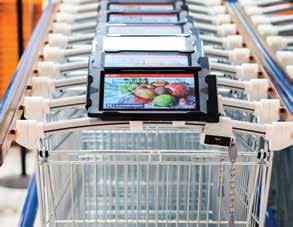
Navigine platform tracks the location of these tablets through Bluetooth® LE beacons installed inside the shop. This would also help the stores in sending push notification for promotions and sales. Furthermore, the information collected by the tablets can be analysed to curate a personalised shopping experience for any given customer.
These shopping carts helped in simplifying internal navigation especially in supermarkets with huge foot-space. They also help in making the shopping more interactive, less frustrating, increase efficiency, and implement better advertising.
A collective heatmap of the customers is also generated thanks to the tablet. This can indicate the in-demand products and help in inventory management for the stores, giving an insight into customer behaviour.
Navigine managed to solve all the above-mentioned problems by doubling the number of Bluetooth beacons, installed inside the shop, using complex algorithms, based on dozens of various parameters, and developing a traffic pattern along with the shop.
Outcome
According to Navigine, at present, the carts equipped with a highly technological navigation system are available in 98 supermarkets all around Finland.
Increasing sales.
Increasing the average check by 6%.
Increasing Kesko brand awareness.
The efficiency of marketing and advertising campaigns – half of all the users of the SmartCart application got special push notifications, 25% of buyers followed the recommended routes to the places with advertised goods. The conversion of such marketing tools reached 6%.
May-June 2023 | www.geospatialworld.net | 37
CASE STUDY
Optimizing Navigation in Southeast Asia with Localized Mapping
Grab, a prominent technology company in Southeast Asia, has developed its in-house mapping system called GrabMaps to provide efficient and accurate navigation for its services.
Challenges
This case study explores how GrabMaps overcomes the challenges of Southeast Asia's unique local nuances that makes navigation difficult by collecting region-specific data, leveraging machine learning, and prioritizing user preferences. The challenges faced are the
The lack of available suppliers for maps that could meet their specific requirements.
Third-party map providers often provided or offered generic data that did not account for the Southeast Asia region's local nuances.
Solutions
Building Localized Mapping Data:
In 2017, Grab’s Geo team made the strategic decision to develop its own maps for Southeast Asia by collecting and classifying mapping data in a local context. This included
Identifying and mapping small and narrow roads commonly used as shortcuts,
Capturing colloquial place names, and
Recognizing priority places such as prayer rooms that are essential for specific Southeast Asian countries.

Machine Learning for Continuous Improvement
Grab has developed country-specific machine learning models that are continually optimized to reduce inaccuracies and gaps in mapping data.
The system collects real-time feedback from driver-partners on the road, both manually and passively.
It monitors road closures based on driver feedback and recognizes patterns where multiple driver-partners avoid certain roads, indicating potential roadblocks.
Customized Routing and Point of Interest (POI) Identification
GrabMaps considers factors such as specific vehicle types and user preferences, to optimize routing and identify points of interest. For e.g., GrabMaps differentiates drop-off points for passengers and food orders from restaurants.
By capturing POI data directly, Grab ensures that its delivery driver-partners are routed to the correct locations, avoiding unnecessary detours.

The system also guides driver-partners to the appropriate parking spaces based on their vehicle type and provides visual cues, such as photos, to help them navigate to the closest entry point or pick-up desk.
Benefits
GrabMaps can adapt and update its data in realtime, providing reliable navigation information.
Maximize food and mart delivery opportunities and minimize wasted time for driver-partners.
38 | www.geospatialworld.net | May-June 2023
CASE STUDY
Tangled Knots
Data Privacy Implications in Retail

While data is essential to offer customized services and keeping a tab on user needs, user privacy violations cannot be overlooked.
With the advent of technology and innovative solutions, face of retail has changed tremendously — from window shopping while ambling through the arcades, to scrolling a product on a mobile app. Yet the fundamental essence stays the same: luring customers at competitive prices.
Be it dinky souks in a crowded alleyway or spacious, amply air-conditioned malls, at the business and marketing level, all strive to attract and retain a loyal customer base.
In today’s age of digitalization and rapid information exchange, data-driven research and development is crucial to retail.
By Richa Tyagi
As a result, retailers are focusing on customized solutions to attract customers, by collecting customers’ data through various means such as online and offline surveys, website cookies, transactional data tracking, IP address tracking, social media monitoring, and subscription and registration.
Most Common Types of Data Violations
Non-compliance with data protection laws
Not sufficient legal basis for data processing
Lack of technical & organizational measures to protect data
Not sufficient fulfillment of customers’ data rights
DATA INSIGHT May-June 2023 | www.geospatialworld.net | 39
Data Analysis
After collecting data from different mediums, retailers analyze these data to gain insights into customers’ buying behavior and predict future spending by providing personalized recommendations. Retailers also used GIS-based tools to draw insights from demographic data, which reveals the relationship between location and people.
Although brands always claimed that they collect data to target customers with a customized and personal approach. However, the growing incidents of data breaches are putting a question mark on retailers. Is the consumers’ data really used only for customization?

And today, consumers are becoming more aware, and concerned about organizations
collecting, using and storing their personal information.
Privacy Concerns
There are several incidents that shows that well-known organizations are using their customers’ data for their benefits.
In July 2021, Amazon was found to be tracking users’ data without acquiring appropriate consent from users or providing the means to opt out from this tracking. Luxembourg National Commission for Data Protection issued a fine in the amount of $888 million for violating the GDPR (General Data Protection Regulation).
The UK ICO (Information Commissioner’s Office) found that Easylife, a catalog retailer had built profiles of 145,400 people for inferred health conditions without their consent.
They made their inferences from the products the customers purchased from Easylife’s Health Catalogue. Because they did not notify their customers of this use of their data, the ICO found that Easylife violated the GDPR article against the “unlawful and invisible” processing of special category data. ICO fined Easylife $1.6 million for data protection and e-marketing violations.
In January 2022, Austrian food retailer REWE International was fined $9 million under the GDPR. The company was allegedly collected users’ data without their consent with its customer loyalty and rewards program, jö Bonus Club and used it for marketing purposes.
Recently, Criteo, a digital advertising platform, is fined $44 million for violating GDPR regu-
40 | www.geospatialworld.net | May-June 2023 DATA INSIGHT
The growing incidents of data breaches are putting a question mark on retailers. Is the consumers’ data used only for customization?
Quick summary of similarities and differences in privacy norms across users’ context:
Focus Areas
General Data Protection Regulation (GDPR) EU
California Consumer Privacy Act (CCPA)
Personal Information Protection Law (PIPL) China
Right to Restrict Processing
Have right to restrict or suppression of their personal data
Prohibit the sale of their information
Have the right to refuse or restrict the use of personal info
Penalty
Enforcement Authorities
Max €20 million or 4% of annual global turnover
European Data Protection Board, EU Commission, & Member State Data Protection Authorities
$7,500 for intentional violations, $2,500 for unintentional violations & $100 to $750 in damages
Prohibit the sale of their information
Up to RMB50 million or 5% of the organization’s total global revenue State cybersecurity and informatization department, plus relevant state council departments
Cross Border Data Transfer
Imposes different cross-border data transfer restrictions based on status of organization
A state law, which doesn't regulate the transfer of personal information across international borders
Imposes different cross-border data transfer restrictions based on status of organization
Categories of Sensitive Info
Collected
Who is Responsible?
Biometric, Genetic, Mental & Physical Health, Political Opinion, Race, Religious Beliefs, Union Membership Data Protection Officer (DPO) not liable for performance of their duties
Social security, driver’s licenses, IDs, passport numbers, log-in accounts, financial accounts Office of the Attorney General (OAG) is responsible for enforcing the regulations
Biometric, Children's Data, Financial Account Info, Geolocation, Government issued ID, Marital Status, Medical, Religious Beliefs
The person in charge of Personal Information Protection is liable for the performance of their duties
May-June 2023 | www.geospatialworld.net | 41
lations. It was using customers’ data for target advertising without their consent and also neglected to provide sufficient information and transparency while respecting individuals’ rights.
What Government Is Doing?
The growing number of data breaches in the retail industry have pushed regulatory bodies to establish stringent compliance norms for data security. Many countries around the world have made their own regulations.
According to Thales Group, all privacy laws are guided by the five global principles:
Make consumers aware of the policies to protect personal information
Providing customers with consent and choices around the use, storage, management and collection of personal data
To make sure that information is going to be used by the right people within the right security protocol
Ensuring that there is no unauthorized access of data
To make sure that the service and platform are aligned with the regulation that enforces compliance.
Data protection laws ultimately focus on to mitigate the risks of fraud, compromise and corruption, and protects the individual. Let’s have a glimpse on key data privacy laws across the globe
GDPR
On May 25th 2018, General Data Protection Regulation (GDPR) came into force. Since then, it has inspired new data privacy legisla-
tion worldwide. As per the GDPR Compliance Regulation, it requires businesses to protect the personal data and privacy of EU citizens. An organization is not only expected to collect users’ personal data legally under stringent norms, but they are also bind to protect the collected data from any exploit or misuse.
California Consumer Privacy Act (CCPA)
In the US, it has a lot of different sectoral laws at the federal level. For example, California Consumer Privacy Act (CCPA) was the nation’s first comprehensive consumer privacy law, passed in 2018.
The law regulates how businesses all over the world are allowed to handle the personal information of California residents.
Personal Information Protection Law (PIPL)
In China, the Personal Information Protection Law (PIPL) came into effect on November 1st, 2021. PIPL was modelled after GDPR, and regulates companies’ use of consumers’ personal information and prevent them moving this information outside of China. The law states that consumers have the right to know how and where their personal data is stored and used.
Proposed Digital India Act & Draft Personal Data Protection Bill, India
In India, the Information Technology Act 2000 is very old. However, the Ministry of Electronics and Information Tech-
nology will soon come up with Digital India Act, 2023 which will replace the Information Technology Act (IT Act) of 2000. The Personal Data Protection Act (PDPA) is also under discussion.
The PDPA intends to provide security of personal data of an individual as well as security of the country. It will not apply only on Indian citizens but also the organizations which do not belong to India but offering the goods and services in India.
User Responsibility
Inspite of the existence of data privacy norms, consumers need to stay aware, vigilant, and conscious about their rights, and the repercussions of data leaks.
At their end, they can follow some basic steps to keep their personal data safe.
Turn off ad personalization.
Most of the brands use web cookies to track users’ location, their interest, and buying patterns; clear the web cookies regularly.
Delete unnecessary apps that you do not really need, use browser instead. Privacy-wise browsers are preferable because they do not access as much information from a user’s phone as an app.
Richa Tyagi
Sub Editor
richa@geospatialworld.net

42 | www.geospatialworld.net | May-June 2023 DATA INSIGHT
Consumers need to stay aware, vigilant, and conscious about their rights, and the repercussions of data leaks
Zeroing in Sites with Right Insights
factors such as sociodemographic data, nearby amenities, transportation networks, and environmental factors like flood zones or wildfire risks.
Besides, in pursuit of their sustainability goals, many companies are prioritizing energy efficiency and addressing climate risks. These areas receive substantial focus as organizations aim to reduce their environmental impact and promote long-term sustainability.
LI’s Role
Clients’ demands
With diverse economic and market situations, today's clients are seeking not only property tenant or transaction information but also comprehensive insights into the surrounding environment and climate-related risks and metrics before zeroing in their site for either business expansion or just starting out afresh.
They are increasingly interested in understanding
In light of these contexts, Location Intelligence plays a crucial role in enriching property information and providing insights into market trends and sustainability metrics based on location. By integrating geospatial data, it enables a deeper understanding of properties and their surroundings, empowering professionals to make informed decisions aligned with market trends and sustainability objectives.
Solution
With geospatial technology, JLL delivers real-time applications that provide various geospatial-related information for any given location, to enable property categorization and risk highlighting.
Besides the real time metrics, with a multi-map system, users can seamlessly explore and analyze this information without switching platforms.
In addition to vector data, JLL leverages raster data from remote sensing, such as solar radiation or wind speed information, to enhance their analysis.


Data
These information sources serve a dual purpose: not only for risk metrics and visualization but also for enriching their features to train machine learning models. Additionally, when combined with AR/VR technologies, they can provide a more immersive and interactive experience for users. Language models can be employed to extract relevant information from text data or even generate text automatically, enhancing the overall capabilities of the system. This integration of diverse technologies empowers us to leverage data, enhance user experiences, and leverage the power of language models for more effective analysis and communication.
May-June 2023 | www.geospatialworld.net | 43
CASE STUDY
St. Louis becomes “GEOINT Central” as Esri announces its move to The Globe Building

She further told the St. Louis Post-Dispatch , “a lot of synergy is coming together in The Globe Building,” Mims was announcing that Esri would be the latest Geospatial Intelligence firm to locate in St. Louis’ newest innovation district – the Downtown North Insight District. The Globe’s and the District’s proximity to the new NGA-St. Louis HQ campus (opening in the first quarter of 2026) is a key location advantage, and has already helped lure other top geospatial companies to locate at The Globe in downtown St. Louis – firms such as General Dynamics, MAXAR, Ball Aerospace, and the U.S. HQ of Sweden-based T-Kartor have each “planted their flags” in the high-tech renovation of the 720,000 square foot Art Deco Globe Building.
There is really no place in the United States or the world that has the enthusiasm, dedication, and interest in developing a geospatial community than St. Louis,” noted Patty Mims, Director for National Government at Esri, in an interview with St. Louis’ National Public Radio affiliate, during the recent 4-day U.S. Geospatial Intelligence Foundation (USGIF) Annual Symposium, convened in St. Louis.

The Redlands, California-based global mapping and locational intelligence firm announced during the U.S. Geospatial Intelligence Foundation (USGIF) 20th Annual Symposium that they would be locating in The Globe Building in downtown St. Louis.
Complementing these Geospatial firms, Westway Enterprises, LLC, recently opened a 75,000 square foot multi-tenant SCIF in the building as well. The new SCIF is just one of three such facilities in the U.S. (the other two being in the Washington, D.C. area).
Among the 4,000 public and private sector leaders participating in the USGIF “From Maps to Metaverse” Symposium was NGA Director Vice Admiral Frank D. Whitworth, who took the occasion to formally name the 100-acre, $1.75-billion, 3,100job National Geospatial-Intelligence Agency (NGA) new HQ “NGA–St. Louis.” In his opening keynote address to Symposium participants, Admiral Whitworth observed, “St. Louis is the place to be if you want to position yourself at the future of GEOINT.”
44 | www.geospatialworld.net | May-June 2023 FEATURED
Patty Mims in her Public Radio interview
St. Louis Public Radio carried an online headline summarizing the NGA Director’s keynote address, which clearly reflected the Admiral’s declaration; namely, “St. Louis’ New Geospatial Identity Is Emerging, And People Across The Country Are Noticing.”
The new center city NGA HQ campus is just blocks from the Downtown North Insight District, which in addition to The Globe Building, also includes The Post
Building, a 226,000 square foot high-tech artful renovation of the former St. Louis Post-Dispatch HQ; along with the GEOINT incubator and NGA Moon Shot Labs at T-Rex; and the 572,000 square foot America’s Center Convention Center (the location for the USGIF Symposia in 2021, 2023, and 2025).
Because of its sophisticated technology features, The Globe Building has been dubbed a “High Tech Castle” and, as the “Location of Choice for Geospatial and Other Tech Firms” because of the high-tech adaptive renovation of this former major railroad station, which ironically once also served as one of NGA’s predecessors during World War II, housing a staff of over 500 map makers for the U.S. Aeronautical Chart Plant facility.
Regarding the continuing evolution of St. Louis in Geospatial Intelligence, GEOINT leader Keith Masback, the decade-long CEO of USGIF, now an angel investor and international geospatial advisor posited, “At the very heart of the origin of the term ‘geospatial intel-


ligence’ was a vision to achieve powerful synergies by combining remote sensing, geospatial data and information, data analysis, and data visualization.” He concluded, “In St. Louis, this has been realized at The Globe Building --- and Esri will both contribute in an impactful way and benefit significantly by joining the community in The Globe Building.”
In this regard, Esri’s Mims observed, “Having all those companies in the same building, the hallway conversations, the lunches, the impromptu meetings, as well as the formal meetings we’ll be putting together is just another way of building that community.”
Steven Stone, owner of The Globe Building, further observed, “The importance of Esri’s growing presence in St. Louis cannot be overstated—Esri staff will certainly play their role at The Globe in making our country safer in partnership with the NGA, but Esri’s growing presence in downtown will also make St. Louis smarter, faster, and more competitive.”
Another Symposium speaker, Sanjay Kumar, Founder and CEO of Geospatial World, underscored the continued growth and scope of this global geospatial cluster. Citing his firm’s newly- published GEOBUIZ 23 Report, Global Geospatial Industry Market Size, Forecast and Growth Trends, Kumar noted, the space and geospatial profession is fast evolving as an industry in itself, with an estimated market size of $512.5 billion in 2023, a market cap of $1.7 trillion, and an economic impact of $7.5 trillion worldwide in 2023.
May-June 2023 | www.geospatialworld.net | 45
Admiral Whitworth keynote at Symposium
Referencing the economic impact of the GEOINT sector, Kumar opined that an anticipated $1.37 trillion geospatial industry by 2030 would have a projected overall economic impact of approximately $30 trillion.
Regions throughout the U.S. and throughout the world –including St. Louis – are aspiring to become Global Geospatial Intelligence Hubs, and to capture their share of this prospective $1.37 trillion market and overall $30 trillion economic impact.
As St. Louis pursues this goal, it continues to demonstrate that it has the unique assets needed for GEOINT growth, to highlight ways in which the St. Louis GEOINT ecosystem has added capacity to meet the needs of Geospatial companies, and to highlight the world-class quality of life amenities and affordability of St. Louis.
Since the landmark site selec-
tion decision in 2016 by then-NGA Director Robert Cardillo to locate NGA’s new campus in North St. Louis, the U.S. Corps of Engineers, and area public and private sector leaders have:
Moved forward with necessary land acquisition and construction of the 100-acre NGA-St. Louis campus, now on schedule for opening in the first quarter of 2026;
Established St. Louis' newest Innovation District, the multi-square block Downtown North Insight District, just blocks-from the new NGA-St. Louis HQ;
Undertaken the high-tech adaptive reuse renovations of The Globe Building and The Post Building;
Recruited and built the 75,000 square foot multi-tenant SCIF at The Globe Building (one of only three such facilities in the U.S.);
Created the new Taylor Geospatial Institute, joining 8

midwestern research institutions and universities in a unique consortium, led by St. Louis University, to pursue broad-gauged strategic applied GEOINT research;
Established a variety of GEOINT Talent Initiatives — focusing on K-12 to undergraduate and graduate levels; and,
Continued the growth of the T-Rex Incubator for start-ups, as well as the recruited NGA's Moon Shot Labs by T-Rex.
Here's hoping that St. Louis can advance as much in the next 2 years as it has since the 2021 USGIF Symposium here – and that St. Louis' development of the Geospatial Intelligence sector can emulate its successful 20-year effort to become a national Plant and Life Sciences Hub.
Dick Fleming
regionalstrategy@me.com
46 | www.geospatialworld.net | May-June 2023 FEATURED
52% 44% 3% 1% Applications 78.06% Applications 59.90% Infrastructure 9.14% GNSS and Positioning Earth Observation Infrastructure 4.65% Distribution 7.97% Distribution 25.65% Analysis 9.33% Analysis 5.31% Earth Observation GNSS and Positioning GIS and Spatial Analytics Sensors and Scanners
USD 202.5 Billion Worth of Investment (including IPO and SPAC in Geospatial (Including Space ) industry)
Source: GeoBuiz Report 2023
CEO, Community Development Ventures, Inc., St. Louis, MO
GLOBAL GEOSPATIAL INDUSTRY MARKET SIZE, FORECAST, AND GROWTH TRENDS
An independent evaluation of all factors and parameters to help the geospatial (and space) industry identify the BEST business opportunities, globally!
WHY GET THE
➜ Geospatial market analysis for 16 countries and 36 sectors: Identify priority geospatial sectors, consumer spread across countries and technology adoption landscape – current & potential for the period 2023-2025.
➜ Geospatial User Map 2023: 1500 users globally are profiled on their use of geospatial technology, aka, a ready-made customer list!
➜ Funding and Investment Trends: An exclusive industry-first detailed analysis of the geospatial (and space) industry’s funding and investment trends during 2019-2022.
➜ Mergers and Acquisitions Matrix: Use the M&A and Partnerships matrix to strategize your market expansion plans viz-a-viz your competition.
➜ Innovation to Impact Matrix: Know where your company stands across the four dimensions - Leaders, Augmenters, Challengers, and Innovators.
➜ Economic Impact: Use the analysis to plan a positive and influential narrative of your solutions and it’s possible impact across varied sectors, globally.

Market Size and Forecast - 2025:
➝ �By Geospatial technology segment (GNSS and Positioning, GIS and Spatial Analytics, Earth observation, and Sensors and Scanners)
➝ �By Sub-geospatial technology segment
➝ �By Business offerings (OEMs, services and solutions, and system integrators)
➝ �By Region
➝ �By Sector
GEOBUIZ
23:
GEOBUIZ 2023 REPORT? PRICING INFORMATION*
1 License - USD 5000 3 License - USD 6500 5 License - USD 8000 *Once purchased, the report will be digitally delivered in next 3 business days. PRODIPTO GHOSH Associate Director Marketing & Sales, Consulting, Geospatial World Email: prodipto@geospatialworld.net ARCHITA SHAKTAWAT Senior Research Manager Commercial Consulting, Geospatial World Email: archita@geospatialworld.net CONTACT SCAN FOR MORE DETAILS


marlin digital twin eaglebe smart city platform ® WWW.MARLINDT.COM WWW.EAGLEBE.COM WWW.BELMAP.BE Where geospatial insights merge with digital twins. MERKATOR NV/SA VLIEGWEZENLAAN 48 1731 ZELLIK - BELGIUM SOFTWARE DATA SERVICES www.merkator.com
