This article was originally published on Esri’s ArcGIS Blog. We’re grateful for the permission to cross-post it on our platform. All credit to the original author Deane Kensok – ArcGIS Content CTO and publisher. Read the original article here.

This week, Overture Maps released its second version of open map data. One of the important new features in this release is the introduction of Global Entity Reference System (GERS) IDs. GERS IDs have been assigned to over 1.6 million building footprints across several cities in North America, South America, and Europe.
GERS is a system of encoding map data to a shared universal reference, which provides an easy mechanism to conflate data from different data providers based on a specific GERS ID. There are several use cases where this would be helpful for different data themes, and we wanted to demonstrate a couple of them for buildings with this release.
Buildings Enrichment
The Overture Buildings in this release include over 1.3 billion features from multiple data providers, including OpenStreetMap, Microsoft, and Esri Community Maps. The Overture team has conflated these building features into a single data layer and transformed them into a common data schema. The data schema includes the building footprint geometry and a small set of properties (e.g., class, height, names).
The Buildings theme provides a large (and rapidly growing!) collection of building footprints, but there could be other building information that you’d like to add to them for your purposes. This might include property management, risk assessment, economic development, 3D visualization, or other use cases.
USA Structures
One useful dataset that includes rich building information is USA Structures, provided by FEMA in collaboration with other U.S. Agencies. This open data is available for download and as a feature layer in Esri’s ArcGIS Living Atlas of the World. The USA Structures include over 75 million structures larger than 450 square feet for use in flood insurance mitigation and emergency preparedness and response. The USA Structures include their own Universal Unique Identifier (UUID) for each structure, as well as several additional attributes (e.g., occupancy, address, city, county, area, height, coordinates, etc.).
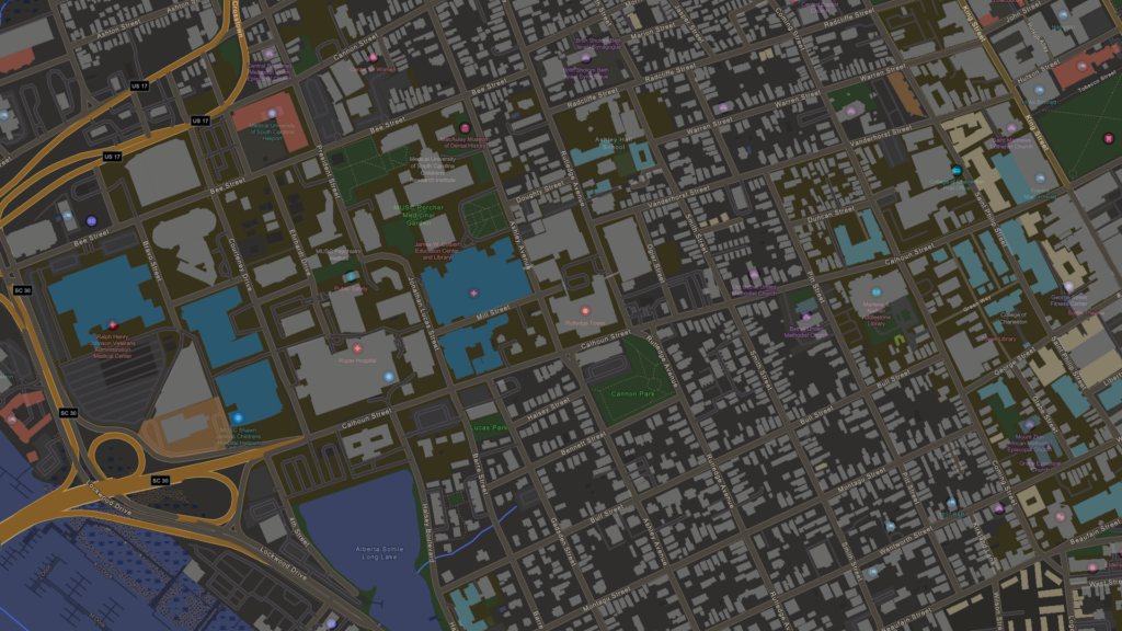
The Overture Buildings with GERS IDs are available for 4 cities in the United States (i.e., Seattle, WA; Spokane, WA; Macon, GA, and Charleston, SC). The USA Structures data can be overlaid on the Overture Buildings to see that, while there are significant differences in the building geometry given different data acquisition procedures, there is also a substantial amount of overlap between the different data sources.
 Figure 1: Overture Buildings by ‘class’ and displayed with USA Structures outlines
Data Conflation
Given the additional set of attributes available in the USA Structures, we thought it would be a useful dataset to demonstrate conflation with the Overture Buildings. Esri used ArcGIS Pro software to perform a spatial join of the two datasets, appending two additional fields on the USA Structures:
- GERS ID: one or more GERS IDs (up to 3) from the Overture Building(s) that intersected the structure.
- GERS Match: count of the Overture Buildings that intersected the structure.
In this prototype, there were 328,854 structures conflated with Overture Buildings and assigned a GERS ID. Of these, 320,869 (97.6%) had 1 match, 6,254 (1.9%) had 2 matches, and 1,731 (0.5%) had 3 or more matches. Now that these USA Structures features have been assigned a GERS ID, there are a few use cases enabled.
Feature Layer with Enhanced Pop-up
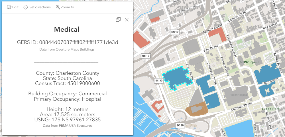
We published both the Overture Buildings with GERS and the USA Structures with GERS IDs as feature layers in Overture’s ArcGIS Online organization. We then created a web map that includes the two layers and authored a custom pop-up for the Overture Buildings layer that is enhanced with additional attributes from the USA Structures.
 Figure 2: Pop-up for Overture Buildings layer, with info from USA Structures layer
In the Overture Buildings layer, we used Arcade and the GERS ID to query the USA Structures layer item and present the additional information in the pop-up. The pop-up only displays information that is available for the selected feature, excluding null and 0 values. Using this enhanced pop-up technique, you can dynamically and efficiently present information based on a shared ID without actually joining the data into a single dataset.
Feature Layer View for Visualization
If you’d like to use the additional attributes for visualization in a web map or scene, you can create a joined view layer. For this use case, we created an Overture USA Building Structures view layer by joining the USA Structures (join layer) to the Overture Buildings (target layer) based on GERS ID. This enables you to symbolize the Overture Buildings data by attributes from the USA Structures layer, such as Building Occupancy. In the 2D map example below, the Overture Buildings are ‘Unclassified’ for this location but can still be symbolized as ‘Residential’ based on attribute from USA Structures.
 Figure 3: Map layer of Overture Buildings symbolized by attribute in USA Structures
In the 3D scene example below, the Overture Buildings are symbolized by their ‘class’ property but, because they do not have many height values in this city, are extruded based on the ‘height’ attribute from USA Structures that has more values.
 Figure 4: Scene layer of Overture Buildings extruded by ‘height’ value in USA Structures
What’s Next
In upcoming releases of Overture data, GERS IDs will be added to many more features in the Buildings data theme and features in other themes such as Transportation and Places. This will enable many more use cases for these data themes, such as sharing road closure information on road segments, and associating businesses with the buildings in which they operate. With these data updates, we will publish more Overture data as ready-to-use layers in ArcGIS and demonstrate additional use cases.
Happy Mapping!
