The world of mapping is often thought of in terms of roads, transportation, and helping people get from one place to another.
But being able to map other factors — such as where people live, where populations are especially dense, where disaster-prone areas lack roads, where people have been vaccinated and where they have not, where drought is extreme and who’s being impacted — tells a deeper story about human conditions and highlights where interventions are needed to improve or save lives.
At the Overture Maps Foundation, we operate on the belief that open map data is essential for effectively mapping the world. We aim to make this data interoperable and as useful as possible for governments, nonprofits, and companies with the capacity to provide critical goods and services.
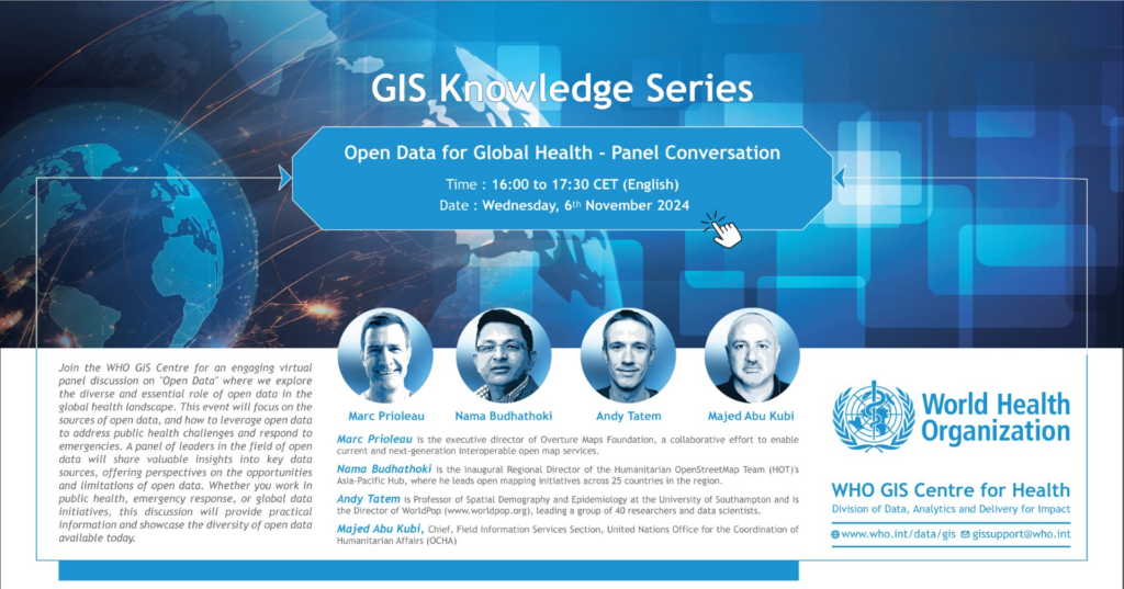
This belief made it especially rewarding to participate in the World Health Organization’s GIS Knowledge Series: Open Data for Global Health webinar on Nov. 6, hosted by the WHO GIS Centre for Health. Alongside colleagues from other parts of the data and mapping community, we discussed how open data is and can be better used to improve global health and humanitarian efforts.
Here are a few of the highlights of the discussion:
Humanitarian OpenStreetMap
“Every human knows something about their community,” stated Nama Budhathoki, regional hub director for Asia for Humanitarian OpenStreetMap Team (HOT), an international team dedicated to humanitarian action and community development through open mapping.
This principle — that everyone knows something about their own community — has driven the success of OpenStreetMap for over twenty years. With OpenStreet Map, individuals can actively participate in mapping what is most important to them, whether it’s a local park with trees or a favorite spot to buy tea, as Nama noted.
Unlike data on proprietary maps, which one can only read, OpenStreetMap relies on community participation to create maps, which is especially crucial in regions where commercial mapping may not be financially viable. This lack of commercial interest can leave entire areas unmapped and thus easily be overlooked by governments and services.
Mapped areas give humanitarian efforts the information needed to make rapid, informed decisions in times of crisis.
Overture makes significant use of OpenStreetMap’s crowdsourced data. About 60% of Overture’s data comes from OpenStreetMap, with the rest coming from government sources and, in the future, from additional sensors and AI-powered tools. We take all of that data, validate it, normalize it, and put it in a standardized schema that helps developers use the data in their applications. Then, we add unique identifiers to each entity in the dataset, making it easier for outside data sources to attach relevant data accurately. In global health, such a robust mapping ecosystem can help pinpoint areas of need, proximity to medical facilities, health impacts from weather events, and much more.
Open data will no doubt be the backbone for future applications. We are especially pleased to have Humanitarian OpenStreetMap as a member of the Overture Maps Foundation. Our membership has grown from just four organizations two years ago to three dozen today, and each member brings valuable contributions to building Overture Maps. If you’re interested in collaboratively, building reliable, easy-to-use, and interoperable open map data, join Overture as a member.
WorldPop
Next on the panel, we heard from Andy Tatem, director of WorldPop, an organization with 40 researchers and data scientists. Andy noted that population data can be incomplete, outdated, and not easily accessible. While this may seem surprising in a country like the U.S. with its census capabilities, it’s a common reality across much of the world.
Population is a critical factor in global health. But, as Andy stated, even with accurate population estimates, additional data linked to population offers a fuller picture. By linking health data with other datasets, the right questions — and the right responses — can be delivered.
Common Operational Datasets
Maps and map data are hardly ever more important than in times of crisis. Majed Abuqubu, of the United Nations Office for the Coordination of Humanitarian Affairs, explained why “Common Operational Datasets” are built, why they’re critical, and why they need to be devoid of bias, especially in today’s polarized political world. The practical use of CODs in Gaza, for instance, note high risk areas, medical facilities, road access, checkpoints and more. All of that information helps with the delivery of humanitarian efforts, Majed noted.
Open data is one thing, but open methods of data collection and display are another. A central tenet of open data is transparency. Everyone can see where data came from and how, if at all, it was altered. This makes map data more trustworthy to anyone using it.
Questions, Answers, Solutions
Sometimes, maps provide answers. Sometimes, they facilitate conversations. Oftentimes, they can inform the making of better decisions. Everyone on the panel with me, I’m sure, is working tirelessly for such outcomes.
To rewatch the panel on demand, please visit here.
Overture looks forward to working with more people, groups, companies, organizations, even countries, to ensure that open map data provides a backbone to improve not only global health, but practically anything that benefits from sharing and mapping knowledge about our world.
Stay connected and follow us on Linkedin and X for the latest updates and discussions. Sign up for Overture’s monthly newsletter and be part of a growing community.
