

We are excited to continue growing our Buildings dataset in Overture’s latest release (Overture 2023-12-14-alpha.0). This release includes over 2.3B buildings, up from 1.4B last month, thanks to the addition of the Google Open Buildings data set. Google Open Buildings consists of 2D building footprints derived from high-resolution satellite imagery providing coverage in Africa, South Asia, South East Asia, and Latin America. We conflated the Google data with our current building footprints from OpenStreetMap, Esri Community Maps, and Microsoft Open Building Footprints.
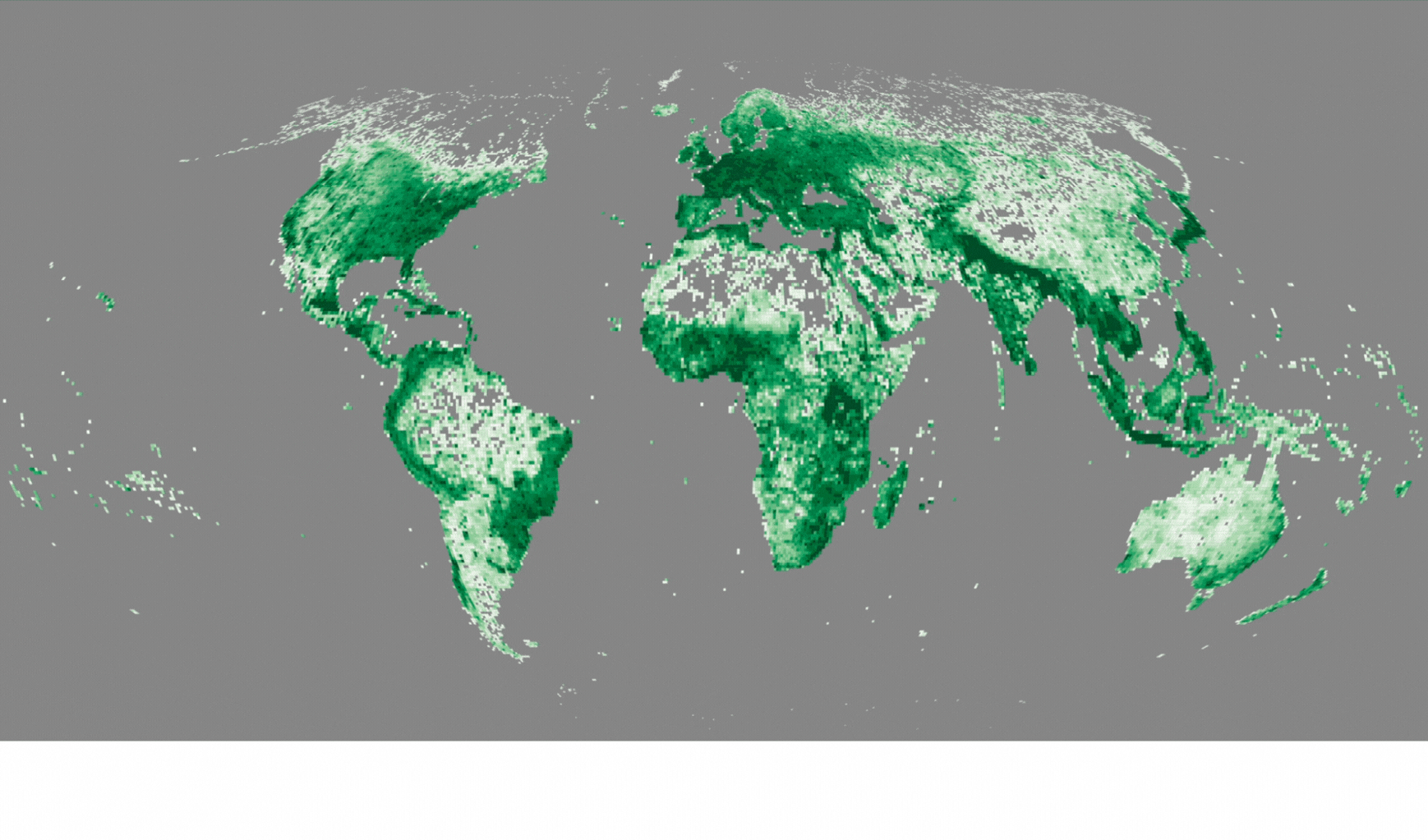
The addition of Google Open Buildings brings the worldwide building count to over 2.3B with significant coverage in India, Africa, Latin America, South Asia, and South East Asia.
Improved Coverage
A core goal of Overture Maps has been to combine open data from various sources to improve the quality and coverage of any single data source. In cases where building footprints overlap, we deduplicate the data based on a ranking of the data. Google’s Open Building Data added significant coverage that was missing in the southern hemisphere. The data also includes confidence scores that allow developers to balance the trade-offs between coverage and accuracy to meet their applications requirements.
GERS IDs Assigned to Buildings
Each building in Overture 2023-12-14-alpha.0 is also associated with a unique identifier, called the Global Entity Reference System ID or GERS ID. These IDs can be used to unambiguously attach all sorts of data to a building, allowing for better data analysis and richer map visualizations. We demonstrated this concept in October using FEMA data and a small sample of buildings in select US cities. In the latest release, we have assigned GERS IDs to the entire corpus of 2.3B buildings, vastly expanding our capability to link many kinds of data associated with buildings to the base layer using GERS.
Any mapping services provider or developer can add their data on top of the building information, creating new use cases ranging from property management, risk assessment, and economic development to 3D visualization and more.
This capability to associate spatial data to a unique entity on the map is a common thread across all of our data themes. While GERS IDs will be specifically tailored to the data type, our goal at Overture Maps is to allow developers to build rich map and spatial experiences through this simple linking of metadata to entities in the base map layer, whether those entities are buildings, roads, addresses or admin boundaries. Jennings Anderson describes this vision more fully in this MapScaping podcast with Daniel O’Donohue.