
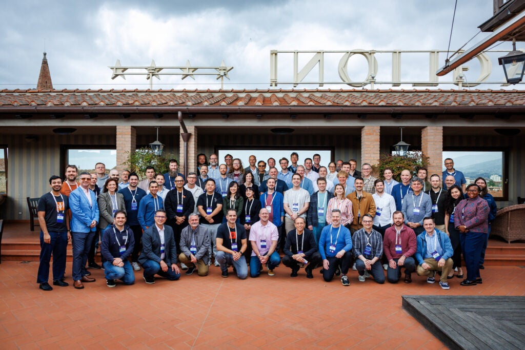
In April, 30+ member organizations gathered in Florence for the third annual Overture Maps Foundation Member Summit. Three days, 28 sessions, and the most renewed version of Overture we’ve felt yet.
The room held members who’ve been with us since the beginning alongside first-time attendees. We connected on the rooftop and under the sunset of Florence, exchanging ideas and inspiring each other. For a project that’s still relatively young, it felt unmistakably like one that’s grown into itself. The post-event survey reflected it: 100% of attendees said they’d recommend Overture membership to others, and the room rated overall event quality at 4.94/5.
Driven by a community passionate about open data and collaboration, this is the year when we can truly say Overture has arrived, becoming the spatial foundation for a growing number of companies.
Real world impact
The Member Summit saw presentations from a wide range of organizations – from commercial enterprises to not-for-profits. While the use cases vary widely from company to company, the underlying mission is the same: build a shared open foundation so no one has to keep rebuilding the basics alone, repeatedly.
Members at the summit shared how they’re putting Overture to work in production.
From Esri shipping Overture at scale inside ArcGIS, GEM (Global Earthquake Model) using Overture’s building footprints to inform earthquake exposure modelling, Addresscloud replacing years of custom integration work, to Precisely showing how GERS has become the connective tissue across their data network.
As Addresscloud CEO Mark Varley put it:
“Overture isn’t just data, it’s foundational infrastructure.”
These stories tell us that different organizations are finding distinct kinds of value in the same open foundation. For some, it’s reliable data production and distribution at scale. For others, it’s the ability to conflate global datasets or fetch only the data they need, fast. What makes this possible is a combination of factors that simply didn’t exist a few years ago: cloud-native geospatial formats and tooling, infrastructure that’s easier to stand up and operate, pipelines that are cheaper to run, and Overture itself as a container for collaboration across organizations that would otherwise be building in parallel. The result is that use cases which were technically conceivable but practically out of reach are now happening.
A shared foundation for AI grounding
One of Overture’s most important jobs over the next twelve months is being the grounding layer for AI. Today, ChatGPT only recommends 1.2% of all local business locations while 83% of restaurants are completely absent from AI-generated recommendations. The lack of standardization across geospatial data, which has always been inefficient, has become structurally untenable in the AI era. Maps without a shared, stable reference system are increasingly unsafe to ground LLM answers on. In order for an AI agent to be useful, it needs additional context to understand spatial relationships. And Overture is built to solve that problem.
We are building an open spatial and location graph to help AI systems reason reliably about the real world. At the center of our approach is the Global Entity Reference System (GERS), a stable and open ID system for the physical world. Every entity including place, road, and administrative boundary in Overture has a stable, resolvable ID, so AI pipelines can anchor their knowledge to a persistent GERS reference instead of guessing whether a name or URL refers to the same real-world entity. Paired with Overture’s schemas and cloud-native data formats, GERS gives AI systems a trusted reference for what exists where. Read more about Overture’s approach to AI grounding here.
Places, Places, Places

Places continues to be our main strategic priority for the year, and the work behind it is some of the most ambitious technical investment Overture has ever made. The dataset sits at around 75 million places globally today. Our new general member BrightQuery is planning to help expand the coverage globally. Working with Development Seed, we’re also using agent-based tooling to ingest authoritative open government data at speed, from business licenses to fuel stations to hawker centres.
At the summit, we announced Places Connect, a new way for business owners to verify and update their own location data through member platforms like Bing Places and Meta Business Manager. Today, owner-verified updates often get overwritten by unverified third-party data. Places Connect routes them through trusted member channels so those edits land in Overture instead of getting lost. We’re moving from passive aggregation toward participatory contribution from the people who actually own and operate the locations.
The quality work is getting more rigorous. A new ML-based Quality Model rolls out in Q3, calibrated across attribute quality, freshness, and spatial accuracy. The conflation pipeline has been overhauled with open source LLMs and agent-driven prompt optimization, pushing combined model accuracy past 98%. Sparkgeo has been leading the signals work that turns contributor data into near real-time updates on Places, with 61% of US places now covered. Each of these changes individually is a meaningful improvement; together, they move Places from a static reference dataset toward something that learns and self-corrects.
The connective work matters just as much. A cross-member Places Imagery Task Force, led by Zephr with engineers from Meta, is using street-level imagery from Mapillary to snap POIs to the right buildings and cut mean geolocation error from 7 meters to 4 meters in pilot regions. Meta is also driving a revamped places category taxonomy that will land on a quarterly release starting later this year, anchored by cognitively intuitive categories that make the data easier for both people and AI to navigate. And new visualization tools built on WebGPU lets anyone explore the full 75M+ point dataset on a laptop, surfacing quality issues that sampled views completely miss.
What ties this together is that none of it is happening inside Overture alone. The best work in Places (and in many areas) is coming from members bringing their expertise and contributing to the open commons. Overture’s Places data is getting bigger, better, faster, and more participatory.
If you’d like to be part of this effort and have places data or signals to contribute, we’d love to talk.
What 40+ organizations build together that none could build alone
Overture is built on the idea that the whole should be greater than the sum of its parts. Florence brought plenty of evidence of that, from members putting Overture to work in production to members contributing back into the project itself.
Uber brought a formal evaluation framework to assess Overture’s POI and address data against operational thresholds, the results of which showed Overture clearing Uber’s production bar.
And the work isn’t only commercial. AddressForAll, a Brazilian non-profit, is helping national statistics agencies in Latin America and Africa publish authoritative address data: 22 million addresses in Colombia, 105 million Brazilian address points cleaned and validated, Cameroon on track to be the first African country with a complete address database in Overture. The Humanitarian OpenStreetMap Team presented the Open Mapping Marketplace, a way for members to commission accredited local mappers to fill coverage gaps in regions where commercial maps don’t reach.
Members are also contributing back to the data itself. Microsoft is donating a new schema for Colloquial Regions (informal geographies like “Central Texas” or “West Africa” that don’t appear on administrative maps), plus 200+ initial regions. Without it, search engines return “Central Texas College” when someone searches for “Central Texas.” Intellias runs IntelliMapLab, pairing university students with senior GIS engineers on real Overture work; this year’s outputs include a GraphHopper adapter and a Map Statistic Framework. The kind of long-game investment that compounds.
What ties these stories together:
- Less plumbing, more product. Teams stop reinventing the wheel, and focus on the features their users actually see.
- Speed-to-production. What used to take months happens in weeks.
- Lower barrier, wider reach. From Fortune 100s to small NGOs, a single open foundation levels the playing field.
What’s coming
A few of the things shipping over the next two quarters:
- Places Connect, launching in H2
- A new ML-based quality model rolling out in Q3.
- A revamped places category taxonomy on a quarterly release cadence.
- BrightQuery integration, expected to add millions of new places to improve coverage globally.
Join our Community
- Start using Overture. The data is free, open, and available today at overturemaps.org. The Explorer tool is a no-code option for inspecting what’s there. The data guides walk through our six themes.
- Contribute places data. Whether it’s a dataset your team maintains or coverage that lives behind your customer-facing surfaces, there’s a path to putting it into Places. Get in touch and we’ll scope it together.
- Become a member! We’re 40+ companies building a new paradigm for how spatial data works. One that’s more open, more connected, and more valuable for everyone who uses it. Florence reminded us that what our community can build together is bigger than any of us could build alone.
Thank you!
As we reflect on three days together in Florence, we’re struck by how much further the project has come, and by the community that carries it forward. Thank you to every member who made the trip, to every speaker who put their work on the table for the room to push on, to the people who stayed late helping someone else debug, and to the Overture team that made the three days work.
The most interesting things at Florence weren’t on the schedule. They happened when people who’d only ever met in GitHub issues finally shook hands and started building together. That’s the project. That’s where it’s going. And there’s room.
We look forward to gathering again in 2027.
Stay connected: Follow us on LinkedIn, X, and Bluesky for updates. Sign up for the monthly newsletter for technical progress and community initiatives.